You are here: Home > Network List > TA - USArray Transportable Network (new EarthScope stations) Stations List
> Station M47A Cromwell, IN, USA > Earthquake Result Viewer
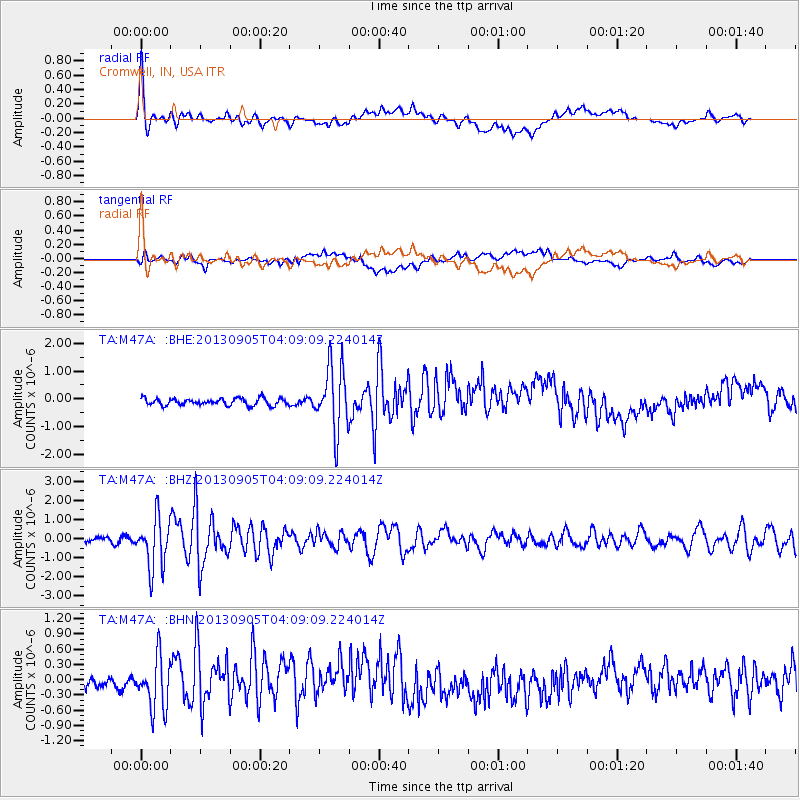
M47A Cromwell, IN, USA - Earthquake Result Viewer
*The percent match for this event was below the threshold and hence no stack was calculated.
| Earthquake location: |
Northern Mid-Atlantic Ridge |
| Earthquake latitude/longitude: |
15.2/-45.2 |
| Earthquake time(UTC): |
2013/09/05 (248) 04:01:36 GMT |
| Earthquake Depth: |
10 km |
| Earthquake Magnitude: |
6.0 MWW, 5.9 MWB, 6.0 MWW, 6.0 MWC |
| Earthquake Catalog/Contributor: |
NEIC PDE/NEIC COMCAT |
|
| Network: |
TA USArray Transportable Network (new EarthScope stations) |
| Station: |
M47A Cromwell, IN, USA |
| Lat/Lon: |
41.36 N/85.62 W |
| Elevation: |
283 m |
|
| Distance: |
43.5 deg |
| Az: |
314.916 deg |
| Baz: |
114.731 deg |
| Ray Param: |
$rayparam |
*The percent match for this event was below the threshold and hence was not used in the summary stack. |
|
| Radial Match: |
68.613525 % |
| Radial Bump: |
400 |
| Transverse Match: |
41.063435 % |
| Transverse Bump: |
400 |
| SOD ConfigId: |
626651 |
| Insert Time: |
2014-04-18 12:46:51.719 +0000 |
| GWidth: |
2.5 |
| Max Bumps: |
400 |
| Tol: |
0.001 |
|
Signal To Noise
| Channel | StoN | STA | LTA |
| TA:M47A: :BHZ:20130905T04:09:09.224014Z | 10.54222 | 1.3174113E-6 | 1.2496525E-7 |
| TA:M47A: :BHN:20130905T04:09:09.224014Z | 3.555954 | 5.1497E-7 | 1.4481908E-7 |
| TA:M47A: :BHE:20130905T04:09:09.224014Z | 9.345565 | 1.1611613E-6 | 1.2424732E-7 |
| Arrivals |
| Ps | |
| PpPs | |
| PsPs/PpSs | |


