You are here: Home > Network List > TA - USArray Transportable Network (new EarthScope stations) Stations List
> Station P57A Homestead Farm, Martinsburg, WV, USA > Earthquake Result Viewer
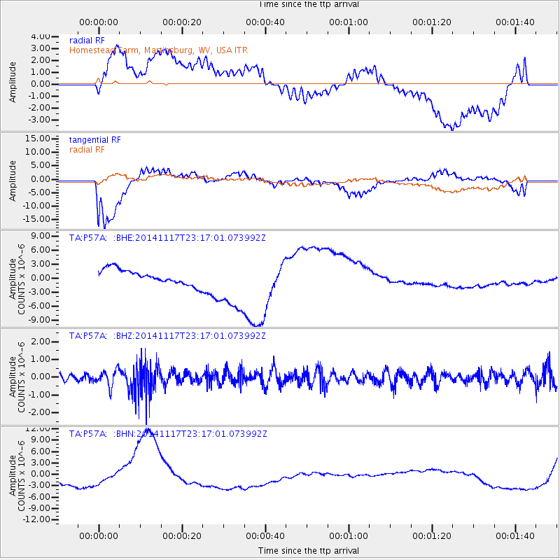
P57A Homestead Farm, Martinsburg, WV, USA - Earthquake Result Viewer
*The percent match for this event was below the threshold and hence no stack was calculated.
| Earthquake location: |
Greece |
| Earthquake latitude/longitude: |
38.6/23.4 |
| Earthquake time(UTC): |
2014/11/17 (321) 23:05:55 GMT |
| Earthquake Depth: |
8.8 km |
| Earthquake Magnitude: |
5.3 MW, 5.4 mb, 5.0 MS |
| Earthquake Catalog/Contributor: |
ISC/ISC |
|
| Network: |
TA USArray Transportable Network (new EarthScope stations) |
| Station: |
P57A Homestead Farm, Martinsburg, WV, USA |
| Lat/Lon: |
39.48 N/78.01 W |
| Elevation: |
191 m |
|
| Distance: |
74.1 deg |
| Az: |
307.932 deg |
| Baz: |
52.945 deg |
| Ray Param: |
$rayparam |
*The percent match for this event was below the threshold and hence was not used in the summary stack. |
|
| Radial Match: |
42.98756 % |
| Radial Bump: |
400 |
| Transverse Match: |
54.970657 % |
| Transverse Bump: |
400 |
| SOD ConfigId: |
3390531 |
| Insert Time: |
2019-04-15 02:21:46.013 +0000 |
| GWidth: |
2.5 |
| Max Bumps: |
400 |
| Tol: |
0.001 |
|
Signal To Noise
| Channel | StoN | STA | LTA |
| TA:P57A: :BHZ:20141117T23:17:01.073992Z | 2.08322 | 4.5489676E-7 | 2.1836233E-7 |
| TA:P57A: :BHN:20141117T23:17:01.073992Z | 0.8747395 | 2.4322167E-6 | 2.780504E-6 |
| TA:P57A: :BHE:20141117T23:17:01.073992Z | 3.944406 | 6.2206814E-6 | 1.5770895E-6 |
| Arrivals |
| Ps | |
| PpPs | |
| PsPs/PpSs | |


