You are here: Home > Network List > TA - USArray Transportable Network (new EarthScope stations) Stations List
> Station U52A Thorn Hill, TN, USA > Earthquake Result Viewer
U52A Thorn Hill, TN, USA - Earthquake Result Viewer

| Earthquake location: |
Northern Mid-Atlantic Ridge |
| Earthquake latitude/longitude: |
15.2/-45.2 |
| Earthquake time(UTC): |
2013/09/05 (248) 04:01:36 GMT |
| Earthquake Depth: |
10 km |
| Earthquake Magnitude: |
6.0 MWW, 5.9 MWB, 6.0 MWW, 6.0 MWC |
| Earthquake Catalog/Contributor: |
NEIC PDE/NEIC COMCAT |
|
| Network: |
TA USArray Transportable Network (new EarthScope stations) |
| Station: |
U52A Thorn Hill, TN, USA |
| Lat/Lon: |
36.39 N/83.37 W |
| Elevation: |
510 m |
|
| Distance: |
40.0 deg |
| Az: |
309.119 deg |
| Baz: |
111.812 deg |
| Ray Param: |
0.074676916 |
| Estimated Moho Depth: |
36.0 km |
| Estimated Crust Vp/Vs: |
2.00 |
| Assumed Crust Vp: |
6.476 km/s |
| Estimated Crust Vs: |
3.238 km/s |
| Estimated Crust Poisson's Ratio: |
0.33 |
|
| Radial Match: |
85.57921 % |
| Radial Bump: |
398 |
| Transverse Match: |
63.715996 % |
| Transverse Bump: |
400 |
| SOD ConfigId: |
626651 |
| Insert Time: |
2014-04-18 12:52:43.895 +0000 |
| GWidth: |
2.5 |
| Max Bumps: |
400 |
| Tol: |
0.001 |
|
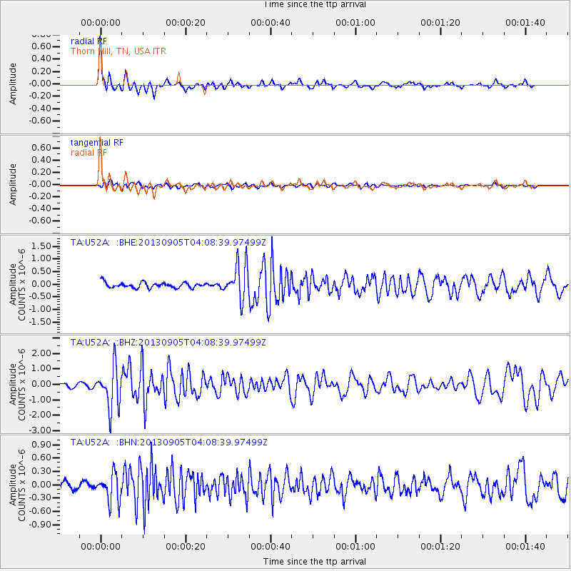
Signal To Noise
| Channel | StoN | STA | LTA |
| TA:U52A: :BHZ:20130905T04:08:39.97499Z | 9.189362 | 1.3740572E-6 | 1.4952695E-7 |
| TA:U52A: :BHN:20130905T04:08:39.97499Z | 3.8216565 | 3.176803E-7 | 8.312634E-8 |
| TA:U52A: :BHE:20130905T04:08:39.97499Z | 6.8063054 | 7.0234785E-7 | 1.0319076E-7 |
| Arrivals |
| Ps | 5.9 SECOND |
| PpPs | 16 SECOND |
| PsPs/PpSs | 22 SECOND |


