You are here: Home > Network List > TA - USArray Transportable Network (new EarthScope stations) Stations List
> Station V62A Hyde County Airport, Englehard, NC, USA > Earthquake Result Viewer
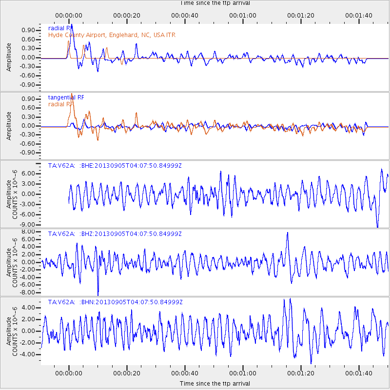
V62A Hyde County Airport, Englehard, NC, USA - Earthquake Result Viewer
*The percent match for this event was below the threshold and hence no stack was calculated.
| Earthquake location: |
Northern Mid-Atlantic Ridge |
| Earthquake latitude/longitude: |
15.2/-45.2 |
| Earthquake time(UTC): |
2013/09/05 (248) 04:01:36 GMT |
| Earthquake Depth: |
10 km |
| Earthquake Magnitude: |
6.0 MWW, 5.9 MWB, 6.0 MWW, 6.0 MWC |
| Earthquake Catalog/Contributor: |
NEIC PDE/NEIC COMCAT |
|
| Network: |
TA USArray Transportable Network (new EarthScope stations) |
| Station: |
V62A Hyde County Airport, Englehard, NC, USA |
| Lat/Lon: |
35.56 N/75.96 W |
| Elevation: |
-3.0 m |
|
| Distance: |
34.2 deg |
| Az: |
312.116 deg |
| Baz: |
118.545 deg |
| Ray Param: |
$rayparam |
*The percent match for this event was below the threshold and hence was not used in the summary stack. |
|
| Radial Match: |
61.714695 % |
| Radial Bump: |
400 |
| Transverse Match: |
41.94915 % |
| Transverse Bump: |
400 |
| SOD ConfigId: |
626651 |
| Insert Time: |
2014-04-18 12:53:43.351 +0000 |
| GWidth: |
2.5 |
| Max Bumps: |
400 |
| Tol: |
0.001 |
|
Signal To Noise
| Channel | StoN | STA | LTA |
| TA:V62A: :BHZ:20130905T04:07:50.84999Z | 2.109247 | 2.7465737E-6 | 1.3021584E-6 |
| TA:V62A: :BHN:20130905T04:07:50.84999Z | 0.92142177 | 1.4618993E-6 | 1.586569E-6 |
| TA:V62A: :BHE:20130905T04:07:50.84999Z | 0.8035544 | 1.8189963E-6 | 2.2636877E-6 |
| Arrivals |
| Ps | |
| PpPs | |
| PsPs/PpSs | |


