You are here: Home > Network List > TA - USArray Transportable Network (new EarthScope stations) Stations List
> Station Z41A Richland Creek Farm, El Dorado, AR, USA > Earthquake Result Viewer
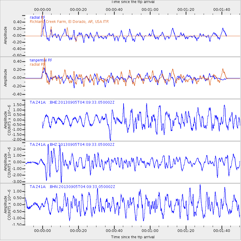
Z41A Richland Creek Farm, El Dorado, AR, USA - Earthquake Result Viewer
*The percent match for this event was below the threshold and hence no stack was calculated.
| Earthquake location: |
Northern Mid-Atlantic Ridge |
| Earthquake latitude/longitude: |
15.2/-45.2 |
| Earthquake time(UTC): |
2013/09/05 (248) 04:01:36 GMT |
| Earthquake Depth: |
10 km |
| Earthquake Magnitude: |
6.0 MWW, 5.9 MWB, 6.0 MWW, 6.0 MWC |
| Earthquake Catalog/Contributor: |
NEIC PDE/NEIC COMCAT |
|
| Network: |
TA USArray Transportable Network (new EarthScope stations) |
| Station: |
Z41A Richland Creek Farm, El Dorado, AR, USA |
| Lat/Lon: |
33.26 N/92.80 W |
| Elevation: |
62 m |
|
| Distance: |
46.5 deg |
| Az: |
301.56 deg |
| Baz: |
100.919 deg |
| Ray Param: |
$rayparam |
*The percent match for this event was below the threshold and hence was not used in the summary stack. |
|
| Radial Match: |
69.83283 % |
| Radial Bump: |
348 |
| Transverse Match: |
69.59108 % |
| Transverse Bump: |
363 |
| SOD ConfigId: |
626651 |
| Insert Time: |
2014-04-18 12:55:21.342 +0000 |
| GWidth: |
2.5 |
| Max Bumps: |
400 |
| Tol: |
0.001 |
|
Signal To Noise
| Channel | StoN | STA | LTA |
| TA:Z41A: :BHZ:20130905T04:09:33.050002Z | 8.087105 | 1.3898156E-6 | 1.7185576E-7 |
| TA:Z41A: :BHN:20130905T04:09:33.050002Z | 1.7272279 | 3.362512E-7 | 1.9467679E-7 |
| TA:Z41A: :BHE:20130905T04:09:33.050002Z | 0.8306695 | 2.9104964E-7 | 3.503796E-7 |
| Arrivals |
| Ps | |
| PpPs | |
| PsPs/PpSs | |


