You are here: Home > Network List > CI - Caltech Regional Seismic Network Stations List
> Station TIN Tinemaha, California, USA > Earthquake Result Viewer
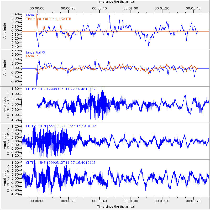
TIN Tinemaha, California, USA - Earthquake Result Viewer
*The percent match for this event was below the threshold and hence no stack was calculated.
| Earthquake location: |
Fiji Islands Region |
| Earthquake latitude/longitude: |
-20.0/-177.8 |
| Earthquake time(UTC): |
1999/03/12 (071) 11:16:39 GMT |
| Earthquake Depth: |
587 km |
| Earthquake Magnitude: |
5.6 MW, 5.2 MB |
| Earthquake Catalog/Contributor: |
WHDF/NEIC |
|
| Network: |
CI Caltech Regional Seismic Network |
| Station: |
TIN Tinemaha, California, USA |
| Lat/Lon: |
37.05 N/118.23 W |
| Elevation: |
1164 m |
|
| Distance: |
79.8 deg |
| Az: |
44.481 deg |
| Baz: |
235.453 deg |
| Ray Param: |
$rayparam |
*The percent match for this event was below the threshold and hence was not used in the summary stack. |
|
| Radial Match: |
42.830418 % |
| Radial Bump: |
400 |
| Transverse Match: |
58.24389 % |
| Transverse Bump: |
400 |
| SOD ConfigId: |
4480 |
| Insert Time: |
2010-02-25 20:51:55.622 +0000 |
| GWidth: |
2.5 |
| Max Bumps: |
400 |
| Tol: |
0.001 |
|
Signal To Noise
| Channel | StoN | STA | LTA |
| CI:TIN: :BHN:19990312T11:27:16.401011Z | 2.4287617 | 5.5799694E-7 | 2.2974545E-7 |
| CI:TIN: :BHE:19990312T11:27:16.401011Z | 1.6642733 | 4.960223E-7 | 2.980414E-7 |
| CI:TIN: :BHZ:19990312T11:27:16.401011Z | 1.5700653 | 4.917801E-7 | 3.132227E-7 |
| Arrivals |
| Ps | |
| PpPs | |
| PsPs/PpSs | |


