You are here: Home > Network List > US - United States National Seismic Network Stations List
> Station GLMI Grayling, Michigan, USA > Earthquake Result Viewer
GLMI Grayling, Michigan, USA - Earthquake Result Viewer

| Earthquake location: |
Northern Mid-Atlantic Ridge |
| Earthquake latitude/longitude: |
15.2/-45.2 |
| Earthquake time(UTC): |
2013/09/05 (248) 04:01:36 GMT |
| Earthquake Depth: |
10 km |
| Earthquake Magnitude: |
6.0 MWW, 5.9 MWB, 6.0 MWW, 6.0 MWC |
| Earthquake Catalog/Contributor: |
NEIC PDE/NEIC COMCAT |
|
| Network: |
US United States National Seismic Network |
| Station: |
GLMI Grayling, Michigan, USA |
| Lat/Lon: |
44.82 N/84.62 W |
| Elevation: |
387 m |
|
| Distance: |
44.4 deg |
| Az: |
319.844 deg |
| Baz: |
118.961 deg |
| Ray Param: |
0.07191208 |
| Estimated Moho Depth: |
63.25 km |
| Estimated Crust Vp/Vs: |
1.72 |
| Assumed Crust Vp: |
6.483 km/s |
| Estimated Crust Vs: |
3.769 km/s |
| Estimated Crust Poisson's Ratio: |
0.24 |
|
| Radial Match: |
83.76732 % |
| Radial Bump: |
400 |
| Transverse Match: |
75.958435 % |
| Transverse Bump: |
400 |
| SOD ConfigId: |
626651 |
| Insert Time: |
2014-04-18 12:56:53.410 +0000 |
| GWidth: |
2.5 |
| Max Bumps: |
400 |
| Tol: |
0.001 |
|
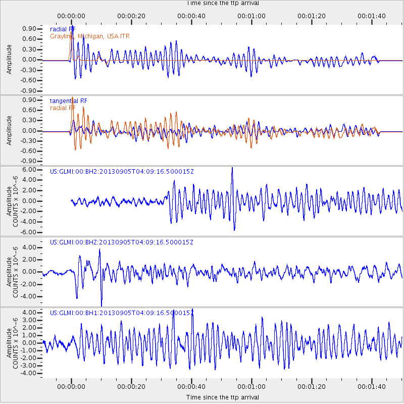
Signal To Noise
| Channel | StoN | STA | LTA |
| US:GLMI:00:BHZ:20130905T04:09:16.500015Z | 4.3103337 | 1.6983363E-6 | 3.9401505E-7 |
| US:GLMI:00:BH1:20130905T04:09:16.500015Z | 2.259884 | 1.1314193E-6 | 5.0065364E-7 |
| US:GLMI:00:BH2:20130905T04:09:16.500015Z | 4.246036 | 1.8007566E-6 | 4.24103E-7 |
| Arrivals |
| Ps | 7.5 SECOND |
| PpPs | 25 SECOND |
| PsPs/PpSs | 32 SECOND |


