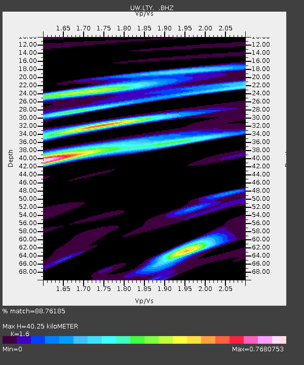
LTY Liberty (broad-band) - Earthquake Result Viewer

Earthquake location: Northern Mid-Atlantic Ridge
Earthquake latitude/longitude: 15.2/-45.2
Earthquake time(UTC): 2013/09/05 (248) 04:01:36 GMT
Earthquake Depth: 10 km
Earthquake Magnitude: 6.0 MWW, 5.9 MWB, 6.0 MWW, 6.0 MWC
Earthquake Catalog/Contributor: NEIC PDE/NEIC COMCAT
Network: UW Pacific Northwest Regional Seismic Network
Station: LTY Liberty (broad-band)
Lat/Lon: 47.26 N/120.66 W
Elevation: 970 m
Distance: 69.1 deg
Az: 315.13 deg
Baz: 90.03 deg
Ray Param: 0.05584016
Estimated Moho Depth: 40.25 km
Estimated Crust Vp/Vs: 1.60
Assumed Crust Vp: 6.597 km/s
Estimated Crust Vs: 4.123 km/s
Estimated Crust Poisson's Ratio: 0.18
Radial Match: 88.76185 %
Radial Bump: 400
Transverse Match: 83.43639 %
Transverse Bump: 400
SOD ConfigId: 626651
Insert Time: 2014-04-18 12:59:45.749 +0000
GWidth: 2.5
Max Bumps: 400
Tol: 0.001

Signal To Noise

ChannelStoNSTALTA
UW:LTY: :BHZ:20130905T04:12:11.539993Z21.5365451.5495112E-67.1947994E-8
UW:LTY: :BHN:20130905T04:12:11.539993Z2.05687881.8529772E-79.008684E-8
UW:LTY: :BHE:20130905T04:12:11.539993Z6.3257294.700026E-77.430015E-8
Arrivals
Ps3.8 SECOND
PpPs15 SECOND
PsPs/PpSs19 SECOND