You are here: Home > Network List > II - Global Seismograph Network (GSN - IRIS/IDA) Stations List
> Station CMLA Cha de Macela, Sao Miguel Island, Azores > Earthquake Result Viewer
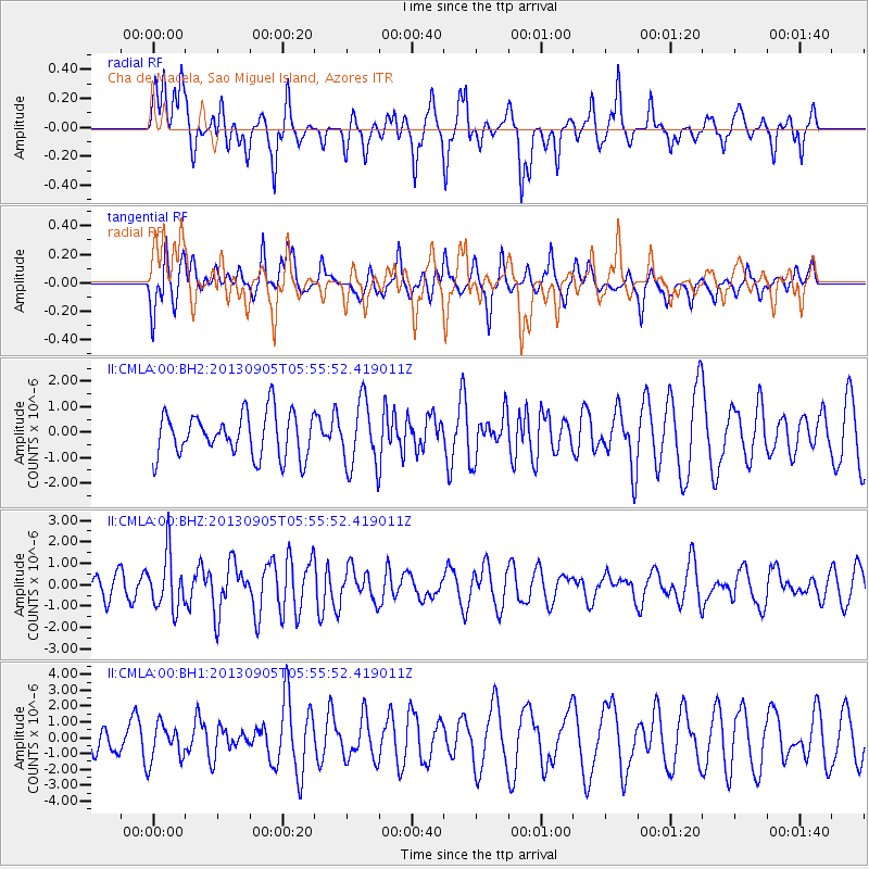
CMLA Cha de Macela, Sao Miguel Island, Azores - Earthquake Result Viewer
*The percent match for this event was below the threshold and hence no stack was calculated.
| Earthquake location: |
Andreanof Islands, Aleutian Is. |
| Earthquake latitude/longitude: |
51.5/-174.6 |
| Earthquake time(UTC): |
2013/09/05 (248) 05:43:39 GMT |
| Earthquake Depth: |
20 km |
| Earthquake Magnitude: |
5.6 MWW, 5.4 MI, 5.5 MWB, 5.6 MWW, 5.7 MWC, 5.7 ML, 5.8 MWC |
| Earthquake Catalog/Contributor: |
NEIC PDE/NEIC COMCAT |
|
| Network: |
II Global Seismograph Network (GSN - IRIS/IDA) |
| Station: |
CMLA Cha de Macela, Sao Miguel Island, Azores |
| Lat/Lon: |
37.76 N/25.52 W |
| Elevation: |
429 m |
|
| Distance: |
87.1 deg |
| Az: |
24.08 deg |
| Baz: |
341.213 deg |
| Ray Param: |
$rayparam |
*The percent match for this event was below the threshold and hence was not used in the summary stack. |
|
| Radial Match: |
60.87372 % |
| Radial Bump: |
378 |
| Transverse Match: |
49.474136 % |
| Transverse Bump: |
326 |
| SOD ConfigId: |
626651 |
| Insert Time: |
2014-04-18 13:11:14.417 +0000 |
| GWidth: |
2.5 |
| Max Bumps: |
400 |
| Tol: |
0.001 |
|
Signal To Noise
| Channel | StoN | STA | LTA |
| II:CMLA:00:BHZ:20130905T05:55:52.419011Z | 1.9827334 | 1.2885597E-6 | 6.498906E-7 |
| II:CMLA:00:BH1:20130905T05:55:52.419011Z | 1.4772388 | 1.1581134E-6 | 7.839717E-7 |
| II:CMLA:00:BH2:20130905T05:55:52.419011Z | 1.5165424 | 1.2930398E-6 | 8.526235E-7 |
| Arrivals |
| Ps | |
| PpPs | |
| PsPs/PpSs | |


