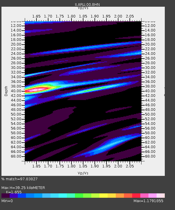
ARU Arti, Russia - Earthquake Result Viewer

Earthquake location: Minahassa Peninsula, Sulawesi
Earthquake latitude/longitude: 1.0/120.4
Earthquake time(UTC): 1996/07/22 (204) 14:19:35 GMT
Earthquake Depth: 33 km
Earthquake Magnitude: 6.0 MB, 6.9 MS, 7.0 UNKNOWN, 6.9 MW
Earthquake Catalog/Contributor: WHDF/NEIC
Network: II Global Seismograph Network (GSN - IRIS/IDA)
Station: ARU Arti, Russia
Lat/Lon: 56.43 N/58.56 E
Elevation: 250 m
Distance: 74.0 deg
Az: 329.348 deg
Baz: 113.427 deg
Ray Param: 0.052599963
Estimated Moho Depth: 39.25 km
Estimated Crust Vp/Vs: 1.65
Assumed Crust Vp: 6.159 km/s
Estimated Crust Vs: 3.721 km/s
Estimated Crust Poisson's Ratio: 0.21
Radial Match: 97.83827 %
Radial Bump: 289
Transverse Match: 90.618164 %
Transverse Bump: 400
SOD ConfigId: 6273
Insert Time: 2010-03-01 16:46:04.498 +0000
GWidth: 2.5
Max Bumps: 400
Tol: 0.001

Signal To Noise

ChannelStoNSTALTA
II:ARU:00:BHN:19960722T14:30:36.809009Z0.98410741.18244415E-71.2015397E-7
II:ARU:00:BHE:19960722T14:30:36.809009Z1.55617642.1415872E-71.3761854E-7
II:ARU:00:BHZ:19960722T14:30:36.809009Z12.3008447.328013E-75.957325E-8
Arrivals
Ps4.3 SECOND
PpPs16 SECOND
PsPs/PpSs21 SECOND