You are here: Home > Network List > CI - Caltech Regional Seismic Network Stations List
> Station TIN Tinemaha, California, USA > Earthquake Result Viewer
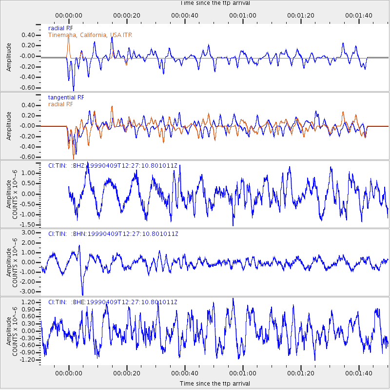
TIN Tinemaha, California, USA - Earthquake Result Viewer
*The percent match for this event was below the threshold and hence no stack was calculated.
| Earthquake location: |
South Of Fiji Islands |
| Earthquake latitude/longitude: |
-26.4/178.2 |
| Earthquake time(UTC): |
1999/04/09 (099) 12:16:01 GMT |
| Earthquake Depth: |
621 km |
| Earthquake Magnitude: |
5.5 MB, 6.2 MW, 6.1 MW |
| Earthquake Catalog/Contributor: |
WHDF/NEIC |
|
| Network: |
CI Caltech Regional Seismic Network |
| Station: |
TIN Tinemaha, California, USA |
| Lat/Lon: |
37.05 N/118.23 W |
| Elevation: |
1164 m |
|
| Distance: |
86.9 deg |
| Az: |
45.835 deg |
| Baz: |
233.565 deg |
| Ray Param: |
$rayparam |
*The percent match for this event was below the threshold and hence was not used in the summary stack. |
|
| Radial Match: |
69.38281 % |
| Radial Bump: |
400 |
| Transverse Match: |
61.528374 % |
| Transverse Bump: |
400 |
| SOD ConfigId: |
4480 |
| Insert Time: |
2010-02-25 20:51:58.927 +0000 |
| GWidth: |
2.5 |
| Max Bumps: |
400 |
| Tol: |
0.001 |
|
Signal To Noise
| Channel | StoN | STA | LTA |
| CI:TIN: :BHN:19990409T12:27:10.801011Z | 2.3201966 | 1.196363E-6 | 5.1563E-7 |
| CI:TIN: :BHE:19990409T12:27:10.801011Z | 0.5827781 | 2.9791826E-7 | 5.1120355E-7 |
| CI:TIN: :BHZ:19990409T12:27:10.801011Z | 0.6867745 | 4.05223E-7 | 5.900379E-7 |
| Arrivals |
| Ps | |
| PpPs | |
| PsPs/PpSs | |


