You are here: Home > Network List > TA - USArray Transportable Network (new EarthScope stations) Stations List
> Station O03E Paynes Creek, CA, USA > Earthquake Result Viewer
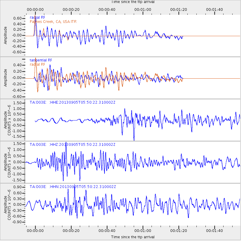
O03E Paynes Creek, CA, USA - Earthquake Result Viewer
*The percent match for this event was below the threshold and hence no stack was calculated.
| Earthquake location: |
Andreanof Islands, Aleutian Is. |
| Earthquake latitude/longitude: |
51.5/-174.6 |
| Earthquake time(UTC): |
2013/09/05 (248) 05:43:39 GMT |
| Earthquake Depth: |
20 km |
| Earthquake Magnitude: |
5.6 MWW, 5.4 MI, 5.5 MWB, 5.6 MWW, 5.7 MWC, 5.7 ML, 5.8 MWC |
| Earthquake Catalog/Contributor: |
NEIC PDE/NEIC COMCAT |
|
| Network: |
TA USArray Transportable Network (new EarthScope stations) |
| Station: |
O03E Paynes Creek, CA, USA |
| Lat/Lon: |
40.29 N/121.80 W |
| Elevation: |
967 m |
|
| Distance: |
37.6 deg |
| Az: |
86.05 deg |
| Baz: |
305.319 deg |
| Ray Param: |
$rayparam |
*The percent match for this event was below the threshold and hence was not used in the summary stack. |
|
| Radial Match: |
78.434944 % |
| Radial Bump: |
400 |
| Transverse Match: |
68.87893 % |
| Transverse Bump: |
400 |
| SOD ConfigId: |
626651 |
| Insert Time: |
2014-04-18 13:30:27.465 +0000 |
| GWidth: |
2.5 |
| Max Bumps: |
400 |
| Tol: |
0.001 |
|
Signal To Noise
| Channel | StoN | STA | LTA |
| TA:O03E: :HHZ:20130905T05:50:22.310002Z | 2.9690182 | 2.2498443E-7 | 7.5777386E-8 |
| TA:O03E: :HHN:20130905T05:50:22.310002Z | 1.5820006 | 1.603759E-7 | 1.0137537E-7 |
| TA:O03E: :HHE:20130905T05:50:22.310002Z | 1.000463 | 1.0801181E-7 | 1.0796182E-7 |
| Arrivals |
| Ps | |
| PpPs | |
| PsPs/PpSs | |


