Q51A Peebles, OH, USA - Earthquake Result Viewer
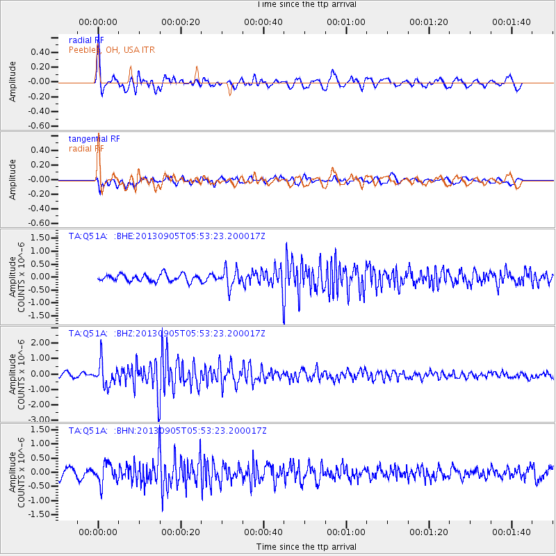
Earthquake location: Andreanof Islands, Aleutian Is.
Earthquake latitude/longitude: 51.5/-174.6
Earthquake time(UTC): 2013/09/05 (248) 05:43:39 GMT
Earthquake Depth: 20 km
Earthquake Magnitude: 5.6 MWW, 5.4 MI, 5.5 MWB, 5.6 MWW, 5.7 MWC, 5.7 ML, 5.8 MWC
Earthquake Catalog/Contributor: NEIC PDE/NEIC COMCAT
Network: TA USArray Transportable Network (new EarthScope stations)
Station: Q51A Peebles, OH, USA
Lat/Lon: 39.03 N/83.35 W
Elevation: 362 m
Distance: 61.4 deg
Az: 62.497 deg
Baz: 314.572 deg
Ray Param: 0.06087717
Estimated Moho Depth: 21.0 km
Estimated Crust Vp/Vs: 2.10
Assumed Crust Vp: 6.232 km/s
Estimated Crust Vs: 2.971 km/s
Estimated Crust Poisson's Ratio: 0.35
Radial Match: 80.03207 %
Radial Bump: 400
Transverse Match: 54.53798 %
Transverse Bump: 400
SOD ConfigId: 626651
Insert Time: 2014-04-18 13:31:51.213 +0000
GWidth: 2.5
Max Bumps: 400
Tol: 0.001

Signal To Noise

ChannelStoNSTALTA
TA:Q51A: :BHZ:20130905T05:53:23.200017Z4.9883077.625715E-71.528718E-7
TA:Q51A: :BHN:20130905T05:53:23.200017Z2.20498753.5229806E-71.5977326E-7
TA:Q51A: :BHE:20130905T05:53:23.200017Z2.50478553.3905923E-71.3536457E-7
Arrivals
Ps3.8 SECOND
PpPs10 SECOND
PsPs/PpSs14 SECOND