S57A Dark Hollow, Roseland, VA, USA - Earthquake Result Viewer
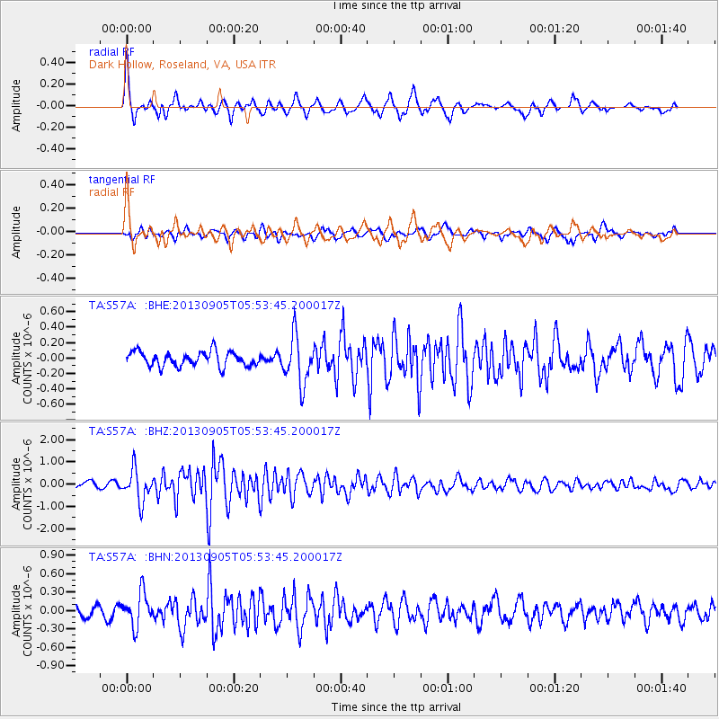
Earthquake location: Andreanof Islands, Aleutian Is.
Earthquake latitude/longitude: 51.5/-174.6
Earthquake time(UTC): 2013/09/05 (248) 05:43:39 GMT
Earthquake Depth: 20 km
Earthquake Magnitude: 5.6 MWW, 5.4 MI, 5.5 MWB, 5.6 MWW, 5.7 MWC, 5.7 ML, 5.8 MWC
Earthquake Catalog/Contributor: NEIC PDE/NEIC COMCAT
Network: TA USArray Transportable Network (new EarthScope stations)
Station: S57A Dark Hollow, Roseland, VA, USA
Lat/Lon: 37.76 N/78.95 W
Elevation: 264 m
Distance: 64.7 deg
Az: 60.727 deg
Baz: 316.487 deg
Ray Param: 0.05872277
Estimated Moho Depth: 67.0 km
Estimated Crust Vp/Vs: 1.85
Assumed Crust Vp: 6.419 km/s
Estimated Crust Vs: 3.465 km/s
Estimated Crust Poisson's Ratio: 0.29
Radial Match: 81.89358 %
Radial Bump: 400
Transverse Match: 73.456696 %
Transverse Bump: 400
SOD ConfigId: 626651
Insert Time: 2014-04-18 13:33:15.681 +0000
GWidth: 2.5
Max Bumps: 400
Tol: 0.001

Signal To Noise

ChannelStoNSTALTA
TA:S57A: :BHZ:20130905T05:53:45.200017Z7.32965047.14631E-79.749865E-8
TA:S57A: :BHN:20130905T05:53:45.200017Z3.68475772.7611972E-77.4935656E-8
TA:S57A: :BHE:20130905T05:53:45.200017Z3.2904253.0980146E-79.415241E-8
Arrivals
Ps9.3 SECOND
PpPs29 SECOND
PsPs/PpSs38 SECOND