
T47A Sharon Grove, KY, USA - Earthquake Result Viewer
| ||||||||||||||||||
| ||||||||||||||||||
| ||||||||||||||||||
|
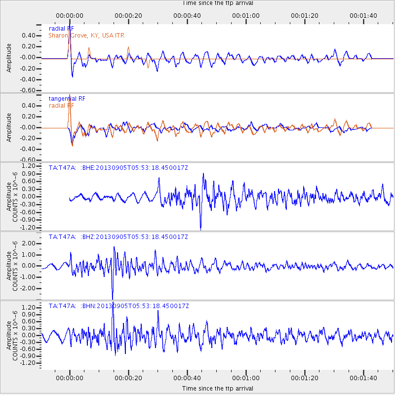
Signal To Noise
| Channel | StoN | STA | LTA |
| TA:T47A: :BHZ:20130905T05:53:18.450017Z | 2.8416507 | 4.95833E-7 | 1.7448765E-7 |
| TA:T47A: :BHN:20130905T05:53:18.450017Z | 1.4766765 | 2.1024759E-7 | 1.4237892E-7 |
| TA:T47A: :BHE:20130905T05:53:18.450017Z | 2.9041095 | 2.7963966E-7 | 9.629102E-8 |
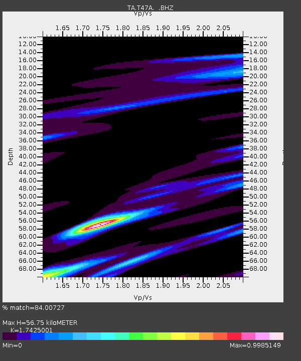
| Arrivals | |
| Ps | 6.9 SECOND |
| PpPs | 23 SECOND |
| PsPs/PpSs | 30 SECOND |

