U57A Blanch, NC, USA - Earthquake Result Viewer
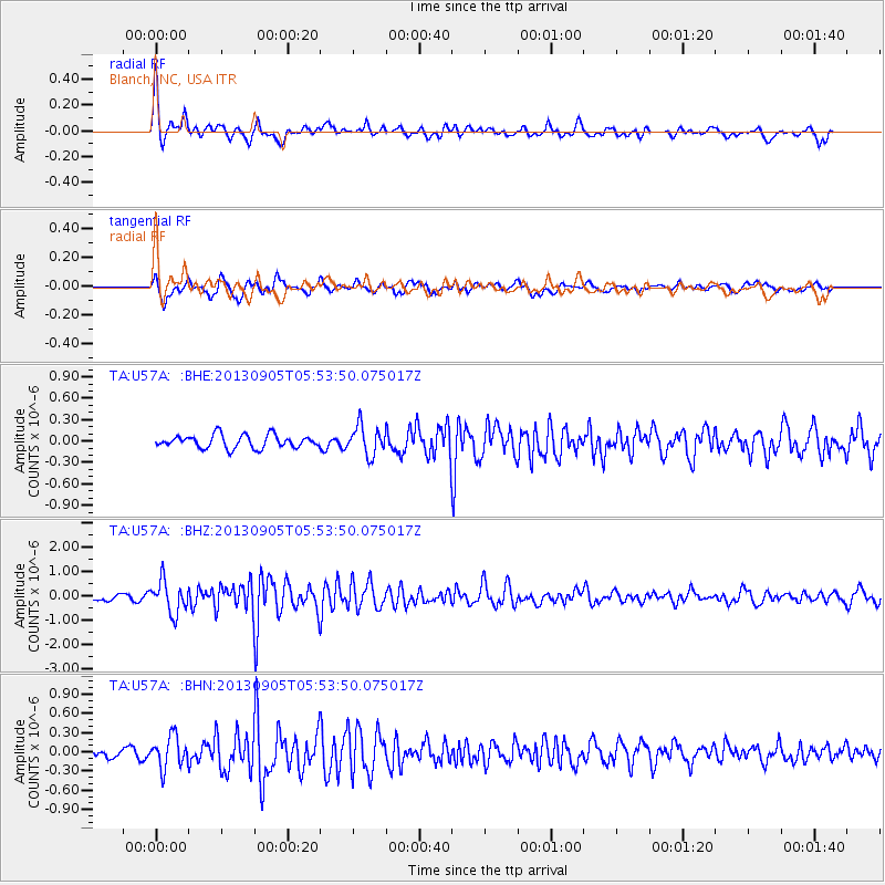
Earthquake location: Andreanof Islands, Aleutian Is.
Earthquake latitude/longitude: 51.5/-174.6
Earthquake time(UTC): 2013/09/05 (248) 05:43:39 GMT
Earthquake Depth: 20 km
Earthquake Magnitude: 5.6 MWW, 5.4 MI, 5.5 MWB, 5.6 MWW, 5.7 MWC, 5.7 ML, 5.8 MWC
Earthquake Catalog/Contributor: NEIC PDE/NEIC COMCAT
Network: TA USArray Transportable Network (new EarthScope stations)
Station: U57A Blanch, NC, USA
Lat/Lon: 36.43 N/79.34 W
Elevation: 178 m
Distance: 65.5 deg
Az: 61.977 deg
Baz: 316.783 deg
Ray Param: 0.058229312
Estimated Moho Depth: 38.75 km
Estimated Crust Vp/Vs: 1.66
Assumed Crust Vp: 6.419 km/s
Estimated Crust Vs: 3.861 km/s
Estimated Crust Poisson's Ratio: 0.22
Radial Match: 80.15152 %
Radial Bump: 389
Transverse Match: 62.67355 %
Transverse Bump: 400
SOD ConfigId: 626651
Insert Time: 2014-04-18 13:34:35.196 +0000
GWidth: 2.5
Max Bumps: 400
Tol: 0.001

Signal To Noise

ChannelStoNSTALTA
TA:U57A: :BHZ:20130905T05:53:50.075017Z5.2300016.5252E-71.247648E-7
TA:U57A: :BHN:20130905T05:53:50.075017Z2.45722482.4477262E-79.961344E-8
TA:U57A: :BHE:20130905T05:53:50.075017Z2.21105122.0230026E-79.149505E-8
Arrivals
Ps4.2 SECOND
PpPs15 SECOND
PsPs/PpSs20 SECOND