You are here: Home > Network List > AZ - ANZA Regional Network Stations List
> Station SMER AZ.SMER > Earthquake Result Viewer
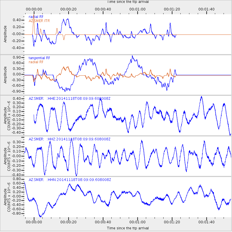
SMER AZ.SMER - Earthquake Result Viewer
*The percent match for this event was below the threshold and hence no stack was calculated.
| Earthquake location: |
Northern Mid-Atlantic Ridge |
| Earthquake latitude/longitude: |
31.6/-40.8 |
| Earthquake time(UTC): |
2014/11/18 (322) 07:59:14 GMT |
| Earthquake Depth: |
10 km |
| Earthquake Magnitude: |
5.4 MW, 5.0 mb, 4.7 MS |
| Earthquake Catalog/Contributor: |
ISC/ISC |
|
| Network: |
AZ ANZA Regional Network |
| Station: |
SMER AZ.SMER |
| Lat/Lon: |
33.46 N/117.17 W |
| Elevation: |
355 m |
|
| Distance: |
63.0 deg |
| Az: |
294.194 deg |
| Baz: |
68.52 deg |
| Ray Param: |
$rayparam |
*The percent match for this event was below the threshold and hence was not used in the summary stack. |
|
| Radial Match: |
58.23639 % |
| Radial Bump: |
400 |
| Transverse Match: |
45.69876 % |
| Transverse Bump: |
400 |
| SOD ConfigId: |
3390531 |
| Insert Time: |
2019-04-15 02:37:04.280 +0000 |
| GWidth: |
2.5 |
| Max Bumps: |
400 |
| Tol: |
0.001 |
|
Signal To Noise
| Channel | StoN | STA | LTA |
| AZ:SMER: :HHZ:20141118T08:09:09.608008Z | 1.3146796 | 1.6337056E-7 | 1.2426645E-7 |
| AZ:SMER: :HHN:20141118T08:09:09.608008Z | 1.8677847 | 7.3215887E-7 | 3.9199318E-7 |
| AZ:SMER: :HHE:20141118T08:09:09.608008Z | 0.93295145 | 1.9772611E-7 | 2.1193613E-7 |
| Arrivals |
| Ps | |
| PpPs | |
| PsPs/PpSs | |


