You are here: Home > Network List > TA - USArray Transportable Network (new EarthScope stations) Stations List
> Station Z53A Monticello, GA, USA > Earthquake Result Viewer
Z53A Monticello, GA, USA - Earthquake Result Viewer
*The percent match for this event was below the threshold and hence no stack was calculated.
| Earthquake location: |
Andreanof Islands, Aleutian Is. |
| Earthquake latitude/longitude: |
51.5/-174.6 |
| Earthquake time(UTC): |
2013/09/05 (248) 05:43:39 GMT |
| Earthquake Depth: |
20 km |
| Earthquake Magnitude: |
5.6 MWW, 5.4 MI, 5.5 MWB, 5.6 MWW, 5.7 MWC, 5.7 ML, 5.8 MWC |
| Earthquake Catalog/Contributor: |
NEIC PDE/NEIC COMCAT |
|
| Network: |
TA USArray Transportable Network (new EarthScope stations) |
| Station: |
Z53A Monticello, GA, USA |
| Lat/Lon: |
33.28 N/83.57 W |
| Elevation: |
144 m |
|
| Distance: |
65.4 deg |
| Az: |
67.134 deg |
| Baz: |
316.519 deg |
| Ray Param: |
$rayparam |
*The percent match for this event was below the threshold and hence was not used in the summary stack. |
|
| Radial Match: |
69.83097 % |
| Radial Bump: |
400 |
| Transverse Match: |
54.09881 % |
| Transverse Bump: |
400 |
| SOD ConfigId: |
626651 |
| Insert Time: |
2014-04-18 13:37:02.368 +0000 |
| GWidth: |
2.5 |
| Max Bumps: |
400 |
| Tol: |
0.001 |
|
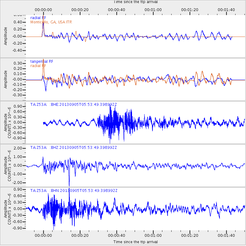
Signal To Noise
| Channel | StoN | STA | LTA |
| TA:Z53A: :BHZ:20130905T05:53:49.398992Z | 5.6173944 | 4.4618815E-7 | 7.942974E-8 |
| TA:Z53A: :BHN:20130905T05:53:49.398992Z | 4.0491185 | 2.7176915E-7 | 6.711811E-8 |
| TA:Z53A: :BHE:20130905T05:53:49.398992Z | 3.0392647 | 2.584721E-7 | 8.504429E-8 |
| Arrivals |
| Ps | |
| PpPs | |
| PsPs/PpSs | |


