You are here: Home > Network List > US - United States National Seismic Network Stations List
> Station AMTX Amarillo, Texas, USA > Earthquake Result Viewer
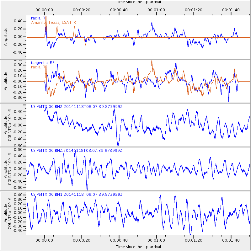
AMTX Amarillo, Texas, USA - Earthquake Result Viewer
*The percent match for this event was below the threshold and hence no stack was calculated.
| Earthquake location: |
Northern Mid-Atlantic Ridge |
| Earthquake latitude/longitude: |
31.6/-40.8 |
| Earthquake time(UTC): |
2014/11/18 (322) 07:59:14 GMT |
| Earthquake Depth: |
10 km |
| Earthquake Magnitude: |
5.4 MW, 5.0 mb, 4.7 MS |
| Earthquake Catalog/Contributor: |
ISC/ISC |
|
| Network: |
US United States National Seismic Network |
| Station: |
AMTX Amarillo, Texas, USA |
| Lat/Lon: |
34.53 N/101.41 W |
| Elevation: |
1010 m |
|
| Distance: |
50.2 deg |
| Az: |
290.544 deg |
| Baz: |
75.307 deg |
| Ray Param: |
$rayparam |
*The percent match for this event was below the threshold and hence was not used in the summary stack. |
|
| Radial Match: |
36.83811 % |
| Radial Bump: |
400 |
| Transverse Match: |
37.915447 % |
| Transverse Bump: |
400 |
| SOD ConfigId: |
3390531 |
| Insert Time: |
2019-04-15 02:42:25.627 +0000 |
| GWidth: |
2.5 |
| Max Bumps: |
400 |
| Tol: |
0.001 |
|
Signal To Noise
| Channel | StoN | STA | LTA |
| US:AMTX:00:BHZ:20141118T08:07:39.873999Z | 0.9514346 | 1.2795448E-7 | 1.3448583E-7 |
| US:AMTX:00:BH1:20141118T08:07:39.873999Z | 0.88436556 | 1.6286145E-7 | 1.8415626E-7 |
| US:AMTX:00:BH2:20141118T08:07:39.873999Z | 1.3592479 | 2.328315E-7 | 1.7129435E-7 |
| Arrivals |
| Ps | |
| PpPs | |
| PsPs/PpSs | |


