You are here: Home > Network List > US - United States National Seismic Network Stations List
> Station ERPA Erie, Pennsylvania, USA > Earthquake Result Viewer
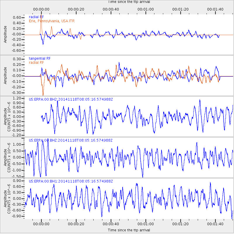
ERPA Erie, Pennsylvania, USA - Earthquake Result Viewer
*The percent match for this event was below the threshold and hence no stack was calculated.
| Earthquake location: |
Northern Mid-Atlantic Ridge |
| Earthquake latitude/longitude: |
31.6/-40.8 |
| Earthquake time(UTC): |
2014/11/18 (322) 07:59:14 GMT |
| Earthquake Depth: |
10 km |
| Earthquake Magnitude: |
5.4 MW, 5.0 mb, 4.7 MS |
| Earthquake Catalog/Contributor: |
ISC/ISC |
|
| Network: |
US United States National Seismic Network |
| Station: |
ERPA Erie, Pennsylvania, USA |
| Lat/Lon: |
42.12 N/79.99 W |
| Elevation: |
306 m |
|
| Distance: |
32.8 deg |
| Az: |
299.756 deg |
| Baz: |
95.647 deg |
| Ray Param: |
$rayparam |
*The percent match for this event was below the threshold and hence was not used in the summary stack. |
|
| Radial Match: |
54.444622 % |
| Radial Bump: |
400 |
| Transverse Match: |
51.21579 % |
| Transverse Bump: |
400 |
| SOD ConfigId: |
3390531 |
| Insert Time: |
2019-04-15 02:42:29.731 +0000 |
| GWidth: |
2.5 |
| Max Bumps: |
400 |
| Tol: |
0.001 |
|
Signal To Noise
| Channel | StoN | STA | LTA |
| US:ERPA:00:BHZ:20141118T08:05:16.574988Z | 1.6555226 | 9.734339E-7 | 5.879919E-7 |
| US:ERPA:00:BH1:20141118T08:05:16.574988Z | 0.74682087 | 2.5983684E-7 | 3.4792393E-7 |
| US:ERPA:00:BH2:20141118T08:05:16.574988Z | 1.647658 | 6.3334943E-7 | 3.8439373E-7 |
| Arrivals |
| Ps | |
| PpPs | |
| PsPs/PpSs | |


