You are here: Home > Network List > CI - Caltech Regional Seismic Network Stations List
> Station TIN Tinemaha, California, USA > Earthquake Result Viewer
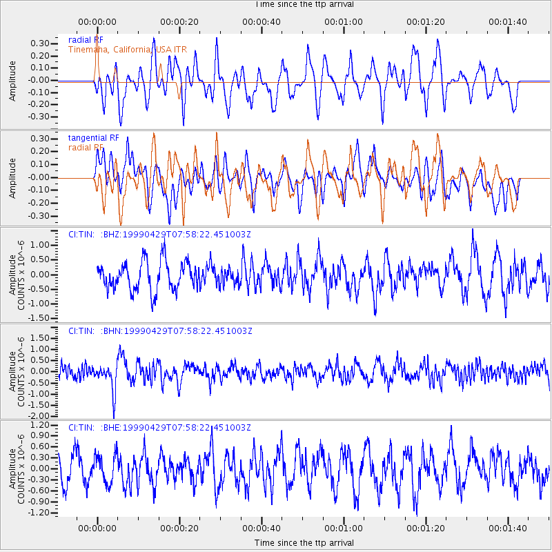
TIN Tinemaha, California, USA - Earthquake Result Viewer
*The percent match for this event was below the threshold and hence no stack was calculated.
| Earthquake location: |
Southeast Of Ryukyu Islands |
| Earthquake latitude/longitude: |
28.9/131.1 |
| Earthquake time(UTC): |
1999/04/29 (119) 07:46:08 GMT |
| Earthquake Depth: |
33 km |
| Earthquake Magnitude: |
5.8 MB, 5.5 MS, 5.9 MW, 5.9 MW |
| Earthquake Catalog/Contributor: |
WHDF/NEIC |
|
| Network: |
CI Caltech Regional Seismic Network |
| Station: |
TIN Tinemaha, California, USA |
| Lat/Lon: |
37.05 N/118.23 W |
| Elevation: |
1164 m |
|
| Distance: |
87.6 deg |
| Az: |
48.536 deg |
| Baz: |
304.755 deg |
| Ray Param: |
$rayparam |
*The percent match for this event was below the threshold and hence was not used in the summary stack. |
|
| Radial Match: |
54.559715 % |
| Radial Bump: |
400 |
| Transverse Match: |
56.105278 % |
| Transverse Bump: |
400 |
| SOD ConfigId: |
4480 |
| Insert Time: |
2010-02-25 20:52:02.476 +0000 |
| GWidth: |
2.5 |
| Max Bumps: |
400 |
| Tol: |
0.001 |
|
Signal To Noise
| Channel | StoN | STA | LTA |
| CI:TIN: :BHN:19990429T07:58:22.451003Z | 2.7973416 | 6.0547535E-7 | 2.1644671E-7 |
| CI:TIN: :BHE:19990429T07:58:22.451003Z | 0.96961534 | 3.869184E-7 | 3.990432E-7 |
| CI:TIN: :BHZ:19990429T07:58:22.451003Z | 0.5323251 | 2.5720894E-7 | 4.831802E-7 |
| Arrivals |
| Ps | |
| PpPs | |
| PsPs/PpSs | |


