You are here: Home > Network List > TA - USArray Transportable Network (new EarthScope stations) Stations List
> Station O03E Paynes Creek, CA, USA > Earthquake Result Viewer
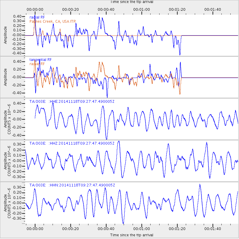
O03E Paynes Creek, CA, USA - Earthquake Result Viewer
*The percent match for this event was below the threshold and hence no stack was calculated.
| Earthquake location: |
Philippine Islands Region |
| Earthquake latitude/longitude: |
19.5/120.5 |
| Earthquake time(UTC): |
2014/11/18 (322) 09:14:49 GMT |
| Earthquake Depth: |
23 km |
| Earthquake Magnitude: |
4.9 mb, 4.8 mb |
| Earthquake Catalog/Contributor: |
ISC/ISC |
|
| Network: |
TA USArray Transportable Network (new EarthScope stations) |
| Station: |
O03E Paynes Creek, CA, USA |
| Lat/Lon: |
40.29 N/121.80 W |
| Elevation: |
967 m |
|
| Distance: |
97.0 deg |
| Az: |
43.009 deg |
| Baz: |
302.751 deg |
| Ray Param: |
$rayparam |
*The percent match for this event was below the threshold and hence was not used in the summary stack. |
|
| Radial Match: |
47.74307 % |
| Radial Bump: |
400 |
| Transverse Match: |
55.165127 % |
| Transverse Bump: |
400 |
| SOD ConfigId: |
3390531 |
| Insert Time: |
2019-04-15 02:49:10.283 +0000 |
| GWidth: |
2.5 |
| Max Bumps: |
400 |
| Tol: |
0.001 |
|
Signal To Noise
| Channel | StoN | STA | LTA |
| TA:O03E: :HHZ:20141118T09:27:47.490005Z | 0.5519292 | 8.005281E-8 | 1.4504181E-7 |
| TA:O03E: :HHN:20141118T09:27:47.490005Z | 0.9774518 | 1.8809034E-7 | 1.9242927E-7 |
| TA:O03E: :HHE:20141118T09:27:47.490005Z | 0.6756342 | 1.2451152E-7 | 1.8428835E-7 |
| Arrivals |
| Ps | |
| PpPs | |
| PsPs/PpSs | |


