You are here: Home > Network List > TA - USArray Transportable Network (new EarthScope stations) Stations List
> Station K48A Perry, MI, USA > Earthquake Result Viewer
K48A Perry, MI, USA - Earthquake Result Viewer

| Earthquake location: |
Off Coast Of Costa Rica |
| Earthquake latitude/longitude: |
10.6/-86.1 |
| Earthquake time(UTC): |
2013/09/05 (248) 12:29:15 GMT |
| Earthquake Depth: |
19 km |
| Earthquake Magnitude: |
5.9 MWW, 5.7 MWB, 5.9 MWW, 5.9 MWC |
| Earthquake Catalog/Contributor: |
NEIC PDE/NEIC COMCAT |
|
| Network: |
TA USArray Transportable Network (new EarthScope stations) |
| Station: |
K48A Perry, MI, USA |
| Lat/Lon: |
42.80 N/84.12 W |
| Elevation: |
273 m |
|
| Distance: |
32.1 deg |
| Az: |
2.741 deg |
| Baz: |
183.662 deg |
| Ray Param: |
0.07876557 |
| Estimated Moho Depth: |
43.75 km |
| Estimated Crust Vp/Vs: |
2.07 |
| Assumed Crust Vp: |
6.483 km/s |
| Estimated Crust Vs: |
3.128 km/s |
| Estimated Crust Poisson's Ratio: |
0.35 |
|
| Radial Match: |
85.38214 % |
| Radial Bump: |
400 |
| Transverse Match: |
60.194042 % |
| Transverse Bump: |
400 |
| SOD ConfigId: |
626651 |
| Insert Time: |
2014-04-18 14:04:44.657 +0000 |
| GWidth: |
2.5 |
| Max Bumps: |
400 |
| Tol: |
0.001 |
|
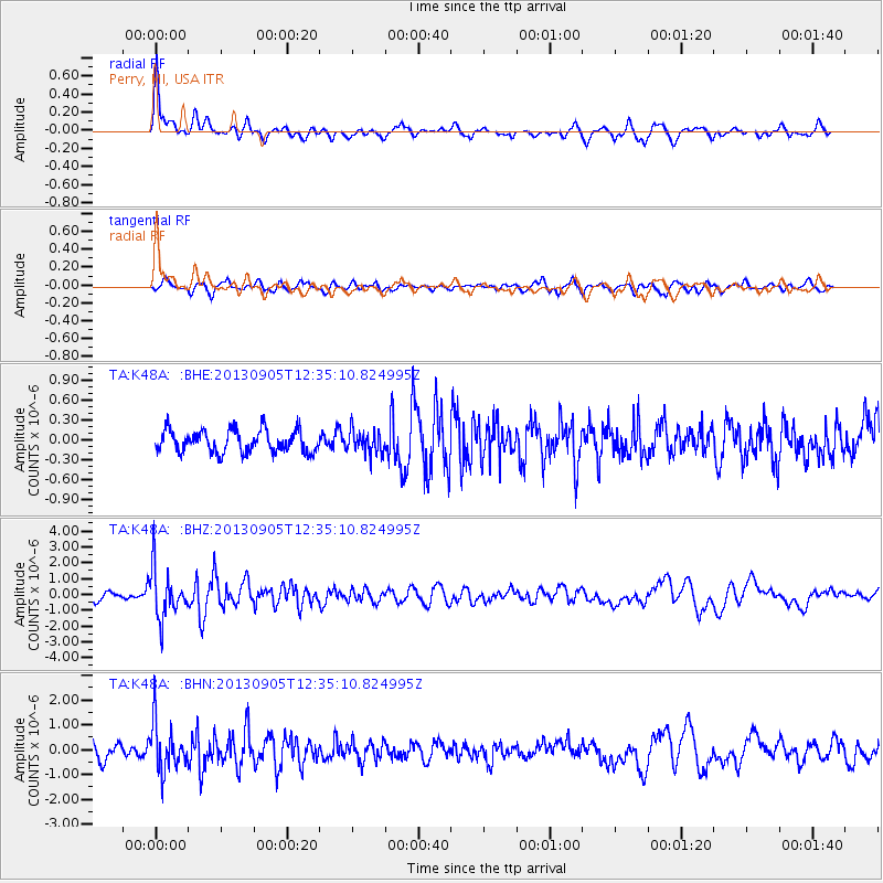
Signal To Noise
| Channel | StoN | STA | LTA |
| TA:K48A: :BHZ:20130905T12:35:10.824995Z | 5.145565 | 1.5439575E-6 | 3.0005597E-7 |
| TA:K48A: :BHN:20130905T12:35:10.824995Z | 3.1691902 | 9.501993E-7 | 2.9982402E-7 |
| TA:K48A: :BHE:20130905T12:35:10.824995Z | 1.0473921 | 1.7530255E-7 | 1.673705E-7 |
| Arrivals |
| Ps | 7.8 SECOND |
| PpPs | 19 SECOND |
| PsPs/PpSs | 27 SECOND |


