You are here: Home > Network List > AZ - ANZA Regional Network Stations List
> Station SMER AZ.SMER > Earthquake Result Viewer
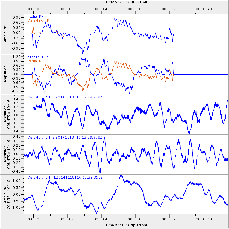
SMER AZ.SMER - Earthquake Result Viewer
*The percent match for this event was below the threshold and hence no stack was calculated.
| Earthquake location: |
Tonga Islands Region |
| Earthquake latitude/longitude: |
-23.6/-175.0 |
| Earthquake time(UTC): |
2014/11/18 (322) 16:02:07 GMT |
| Earthquake Depth: |
19 km |
| Earthquake Magnitude: |
5.0 MW, 5.3 mb, 4.4 MS |
| Earthquake Catalog/Contributor: |
ISC/ISC |
|
| Network: |
AZ ANZA Regional Network |
| Station: |
SMER AZ.SMER |
| Lat/Lon: |
33.46 N/117.17 W |
| Elevation: |
355 m |
|
| Distance: |
79.1 deg |
| Az: |
46.109 deg |
| Baz: |
232.233 deg |
| Ray Param: |
$rayparam |
*The percent match for this event was below the threshold and hence was not used in the summary stack. |
|
| Radial Match: |
34.737972 % |
| Radial Bump: |
400 |
| Transverse Match: |
23.59292 % |
| Transverse Bump: |
400 |
| SOD ConfigId: |
3390531 |
| Insert Time: |
2019-04-15 02:52:42.591 +0000 |
| GWidth: |
2.5 |
| Max Bumps: |
400 |
| Tol: |
0.001 |
|
Signal To Noise
| Channel | StoN | STA | LTA |
| AZ:SMER: :HHZ:20141118T16:13:39.358Z | 0.9222557 | 7.362015E-8 | 7.982618E-8 |
| AZ:SMER: :HHN:20141118T16:13:39.358Z | 2.035485 | 1.0939963E-6 | 5.374622E-7 |
| AZ:SMER: :HHE:20141118T16:13:39.358Z | 1.1547965 | 1.7821718E-7 | 1.5432778E-7 |
| Arrivals |
| Ps | |
| PpPs | |
| PsPs/PpSs | |


