You are here: Home > Network List > AK - Alaska Regional Network Stations List
> Station MDM Murphy Dome > Earthquake Result Viewer
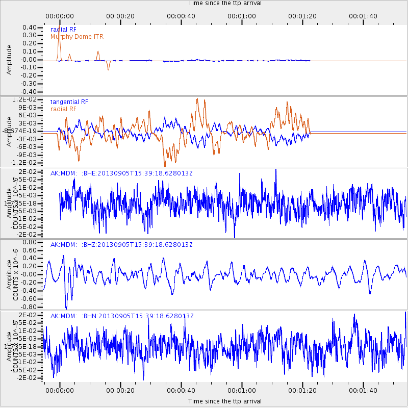
MDM Murphy Dome - Earthquake Result Viewer
*The percent match for this event was below the threshold and hence no stack was calculated.
| Earthquake location: |
Near S Coast Of New Guinea, P.N.G. |
| Earthquake latitude/longitude: |
-7.3/144.0 |
| Earthquake time(UTC): |
2013/09/05 (248) 15:27:03 GMT |
| Earthquake Depth: |
9.6 km |
| Earthquake Magnitude: |
5.5 MW, 5.3 MWB, 5.5 MWC |
| Earthquake Catalog/Contributor: |
NEIC PDE/NEIC COMCAT |
|
| Network: |
AK Alaska Regional Network |
| Station: |
MDM Murphy Dome |
| Lat/Lon: |
64.96 N/148.23 W |
| Elevation: |
634 m |
|
| Distance: |
87.3 deg |
| Az: |
23.223 deg |
| Baz: |
246.797 deg |
| Ray Param: |
$rayparam |
*The percent match for this event was below the threshold and hence was not used in the summary stack. |
|
| Radial Match: |
42.74806 % |
| Radial Bump: |
400 |
| Transverse Match: |
45.24445 % |
| Transverse Bump: |
400 |
| SOD ConfigId: |
626651 |
| Insert Time: |
2014-04-18 14:14:47.956 +0000 |
| GWidth: |
2.5 |
| Max Bumps: |
400 |
| Tol: |
0.001 |
|
Signal To Noise
| Channel | StoN | STA | LTA |
| AK:MDM: :BHZ:20130905T15:39:18.628013Z | 2.2960362 | 3.7030512E-7 | 1.6128017E-7 |
| AK:MDM: :BHN:20130905T15:39:18.628013Z | 1.0776377 | 6.852311E-9 | 6.3586416E-9 |
| AK:MDM: :BHE:20130905T15:39:18.628013Z | 1.103211 | 7.0918325E-9 | 6.428355E-9 |
| Arrivals |
| Ps | |
| PpPs | |
| PsPs/PpSs | |


