You are here: Home > Network List > TA - USArray Transportable Network (new EarthScope stations) Stations List
> Station L04D Klamath Falls, OR, USA > Earthquake Result Viewer
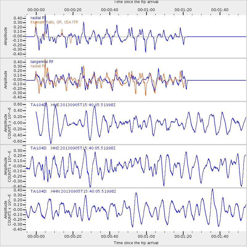
L04D Klamath Falls, OR, USA - Earthquake Result Viewer
*The percent match for this event was below the threshold and hence no stack was calculated.
| Earthquake location: |
Near S Coast Of New Guinea, P.N.G. |
| Earthquake latitude/longitude: |
-7.3/144.0 |
| Earthquake time(UTC): |
2013/09/05 (248) 15:27:03 GMT |
| Earthquake Depth: |
9.6 km |
| Earthquake Magnitude: |
5.5 MW, 5.3 MWB, 5.5 MWC |
| Earthquake Catalog/Contributor: |
NEIC PDE/NEIC COMCAT |
|
| Network: |
TA USArray Transportable Network (new EarthScope stations) |
| Station: |
L04D Klamath Falls, OR, USA |
| Lat/Lon: |
42.22 N/122.30 W |
| Elevation: |
1437 m |
|
| Distance: |
97.5 deg |
| Az: |
48.398 deg |
| Baz: |
267.057 deg |
| Ray Param: |
$rayparam |
*The percent match for this event was below the threshold and hence was not used in the summary stack. |
|
| Radial Match: |
57.566204 % |
| Radial Bump: |
278 |
| Transverse Match: |
62.88552 % |
| Transverse Bump: |
341 |
| SOD ConfigId: |
626651 |
| Insert Time: |
2014-04-18 14:21:29.855 +0000 |
| GWidth: |
2.5 |
| Max Bumps: |
400 |
| Tol: |
0.001 |
|
Signal To Noise
| Channel | StoN | STA | LTA |
| TA:L04D: :HHZ:20130905T15:40:05.51998Z | 1.1073173 | 1.600349E-7 | 1.4452486E-7 |
| TA:L04D: :HHN:20130905T15:40:05.51998Z | 0.5976034 | 1.0410263E-7 | 1.7420021E-7 |
| TA:L04D: :HHE:20130905T15:40:05.51998Z | 1.3080178 | 3.7759423E-7 | 2.8867666E-7 |
| Arrivals |
| Ps | |
| PpPs | |
| PsPs/PpSs | |


