You are here: Home > Network List > CI - Caltech Regional Seismic Network Stations List
> Station TIN Tinemaha, Big Pine, CA, USA > Earthquake Result Viewer
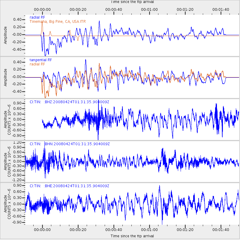
TIN Tinemaha, Big Pine, CA, USA - Earthquake Result Viewer
*The percent match for this event was below the threshold and hence no stack was calculated.
| Earthquake location: |
Loyalty Islands |
| Earthquake latitude/longitude: |
-20.1/168.7 |
| Earthquake time(UTC): |
2008/04/24 (115) 01:19:15 GMT |
| Earthquake Depth: |
35 km |
| Earthquake Magnitude: |
5.7 MW, 5.3 MS, 5.3 MB, 5.6 MW |
| Earthquake Catalog/Contributor: |
WHDF/NEIC |
|
| Network: |
CI Caltech Regional Seismic Network |
| Station: |
TIN Tinemaha, Big Pine, CA, USA |
| Lat/Lon: |
37.05 N/118.23 W |
| Elevation: |
1197 m |
|
| Distance: |
89.2 deg |
| Az: |
49.937 deg |
| Baz: |
244.071 deg |
| Ray Param: |
$rayparam |
*The percent match for this event was below the threshold and hence was not used in the summary stack. |
|
| Radial Match: |
54.814377 % |
| Radial Bump: |
400 |
| Transverse Match: |
52.768417 % |
| Transverse Bump: |
400 |
| SOD ConfigId: |
2504 |
| Insert Time: |
2010-02-25 20:52:04.756 +0000 |
| GWidth: |
2.5 |
| Max Bumps: |
400 |
| Tol: |
0.001 |
|
Signal To Noise
| Channel | StoN | STA | LTA |
| CI:TIN: :BHN:20080424T01:31:35.904009Z | 2.6045647 | 3.955006E-7 | 1.5184902E-7 |
| CI:TIN: :BHE:20080424T01:31:35.904009Z | 0.95210564 | 2.2188311E-7 | 2.3304463E-7 |
| CI:TIN: :BHZ:20080424T01:31:35.904009Z | 1.7764304 | 3.5876624E-7 | 2.0195907E-7 |
| Arrivals |
| Ps | |
| PpPs | |
| PsPs/PpSs | |


