You are here: Home > Network List > CN - Canadian National Seismograph Network Stations List
> Station INK INUVIK, NT > Earthquake Result Viewer
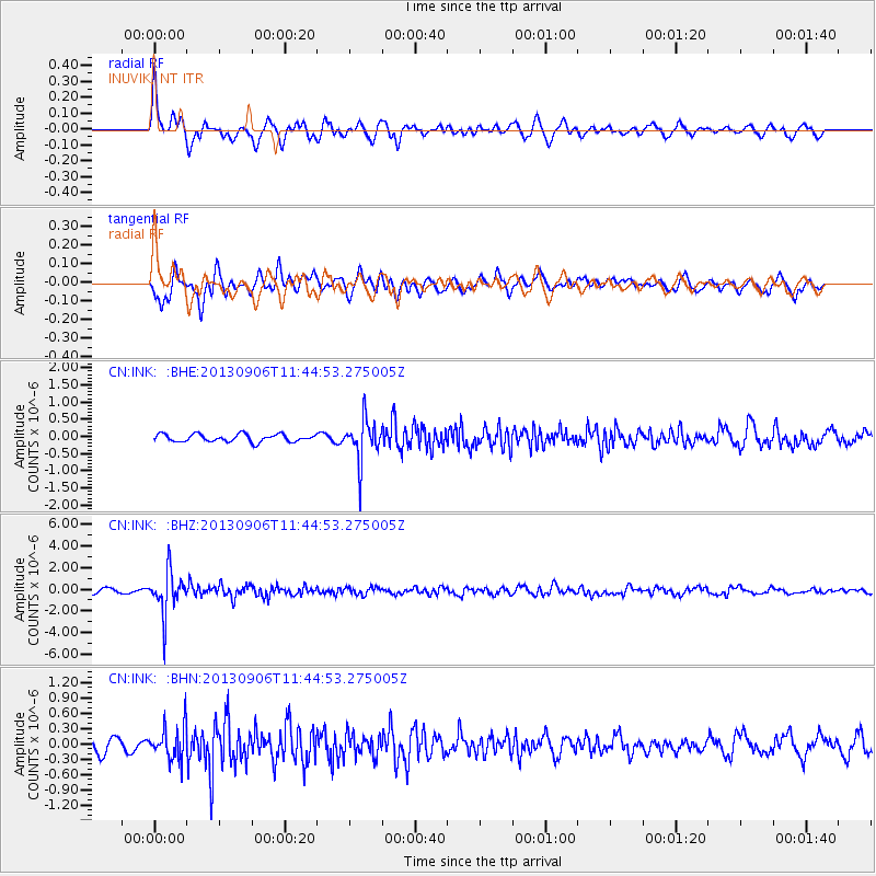
INK INUVIK, NT - Earthquake Result Viewer
*The percent match for this event was below the threshold and hence no stack was calculated.
| Earthquake location: |
Philippine Islands Region |
| Earthquake latitude/longitude: |
20.2/122.3 |
| Earthquake time(UTC): |
2013/09/06 (249) 11:33:53 GMT |
| Earthquake Depth: |
175 km |
| Earthquake Magnitude: |
5.9 MWW, 5.9 MWW, 6.0 MWC, 6.0 MWB |
| Earthquake Catalog/Contributor: |
NEIC PDE/NEIC COMCAT |
|
| Network: |
CN Canadian National Seismograph Network |
| Station: |
INK INUVIK, NT |
| Lat/Lon: |
68.31 N/133.53 W |
| Elevation: |
44 m |
|
| Distance: |
76.5 deg |
| Az: |
21.758 deg |
| Baz: |
290.508 deg |
| Ray Param: |
$rayparam |
*The percent match for this event was below the threshold and hence was not used in the summary stack. |
|
| Radial Match: |
75.324394 % |
| Radial Bump: |
400 |
| Transverse Match: |
79.10976 % |
| Transverse Bump: |
400 |
| SOD ConfigId: |
626651 |
| Insert Time: |
2014-04-18 14:34:10.726 +0000 |
| GWidth: |
2.5 |
| Max Bumps: |
400 |
| Tol: |
0.001 |
|
Signal To Noise
| Channel | StoN | STA | LTA |
| CN:INK: :BHZ:20130906T11:44:53.275005Z | 8.0562315 | 1.9852566E-6 | 2.4642497E-7 |
| CN:INK: :BHN:20130906T11:44:53.275005Z | 2.1259267 | 3.3769268E-7 | 1.5884493E-7 |
| CN:INK: :BHE:20130906T11:44:53.275005Z | 5.4974785 | 6.0774465E-7 | 1.10549706E-7 |
| Arrivals |
| Ps | |
| PpPs | |
| PsPs/PpSs | |


