
KBL Kabul, Afghanistan - Earthquake Result Viewer
| ||||||||||||||||||
| ||||||||||||||||||
| ||||||||||||||||||
|
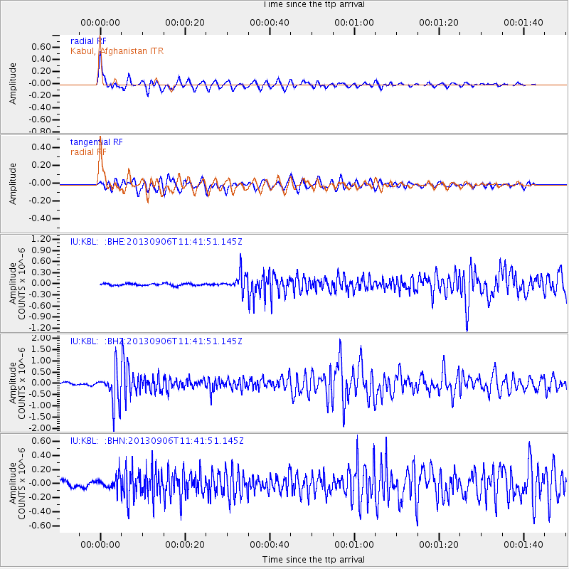
Signal To Noise
| Channel | StoN | STA | LTA |
| IU:KBL: :BHZ:20130906T11:41:51.145Z | 16.284742 | 7.48082E-7 | 4.59376E-8 |
| IU:KBL: :BHN:20130906T11:41:51.145Z | 2.566846 | 9.1148614E-8 | 3.550997E-8 |
| IU:KBL: :BHE:20130906T11:41:51.145Z | 9.083783 | 2.446432E-7 | 2.693186E-8 |
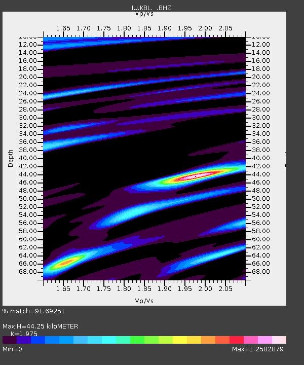
| Arrivals | |
| Ps | 6.9 SECOND |
| PpPs | 19 SECOND |
| PsPs/PpSs | 26 SECOND |

