MAKZ Makanchi, Kazakhstan - Earthquake Result Viewer
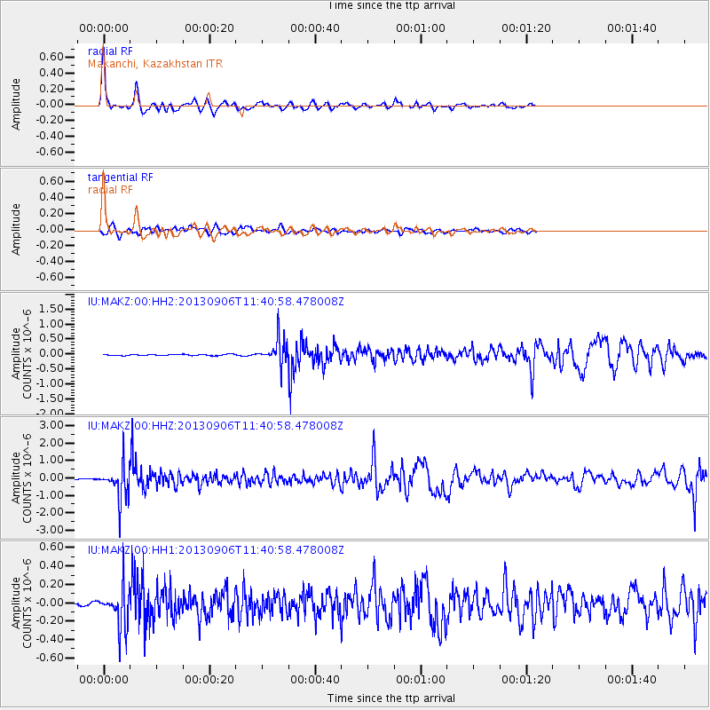
Earthquake location: Philippine Islands Region
Earthquake latitude/longitude: 20.2/122.3
Earthquake time(UTC): 2013/09/06 (249) 11:33:53 GMT
Earthquake Depth: 175 km
Earthquake Magnitude: 5.9 MWW, 5.9 MWW, 6.0 MWC, 6.0 MWB
Earthquake Catalog/Contributor: NEIC PDE/NEIC COMCAT
Network: IU Global Seismograph Network (GSN - IRIS/USGS)
Station: MAKZ Makanchi, Kazakhstan
Lat/Lon: 46.81 N/81.98 E
Elevation: 600 m
Distance: 42.2 deg
Az: 318.538 deg
Baz: 115.103 deg
Ray Param: 0.072669275
Estimated Moho Depth: 49.75 km
Estimated Crust Vp/Vs: 1.77
Assumed Crust Vp: 6.571 km/s
Estimated Crust Vs: 3.702 km/s
Estimated Crust Poisson's Ratio: 0.27
Radial Match: 96.2828 %
Radial Bump: 325
Transverse Match: 79.40101 %
Transverse Bump: 400
SOD ConfigId: 626651
Insert Time: 2014-04-18 14:38:10.288 +0000
GWidth: 2.5
Max Bumps: 400
Tol: 0.001

Signal To Noise

ChannelStoNSTALTA
IU:MAKZ:00:HHZ:20130906T11:40:58.478008Z21.1757569.383036E-74.4310273E-8
IU:MAKZ:00:HH1:20130906T11:40:58.478008Z11.6272192.2099502E-71.9006697E-8
IU:MAKZ:00:HH2:20130906T11:40:58.478008Z21.244154.332383E-72.0393298E-8
Arrivals
Ps6.3 SECOND
PpPs20 SECOND
PsPs/PpSs26 SECOND