You are here: Home > Network List > US - United States National Seismic Network Stations List
> Station EGMT Eagleton, Montana, USA > Earthquake Result Viewer
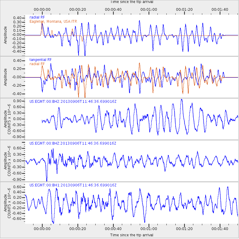
EGMT Eagleton, Montana, USA - Earthquake Result Viewer
*The percent match for this event was below the threshold and hence no stack was calculated.
| Earthquake location: |
Philippine Islands Region |
| Earthquake latitude/longitude: |
20.2/122.3 |
| Earthquake time(UTC): |
2013/09/06 (249) 11:33:53 GMT |
| Earthquake Depth: |
175 km |
| Earthquake Magnitude: |
5.9 MWW, 5.9 MWW, 6.0 MWC, 6.0 MWB |
| Earthquake Catalog/Contributor: |
NEIC PDE/NEIC COMCAT |
|
| Network: |
US United States National Seismic Network |
| Station: |
EGMT Eagleton, Montana, USA |
| Lat/Lon: |
48.02 N/109.75 W |
| Elevation: |
1055 m |
|
| Distance: |
97.7 deg |
| Az: |
32.297 deg |
| Baz: |
311.608 deg |
| Ray Param: |
$rayparam |
*The percent match for this event was below the threshold and hence was not used in the summary stack. |
|
| Radial Match: |
43.057003 % |
| Radial Bump: |
361 |
| Transverse Match: |
54.74743 % |
| Transverse Bump: |
325 |
| SOD ConfigId: |
626651 |
| Insert Time: |
2014-04-18 14:43:28.859 +0000 |
| GWidth: |
2.5 |
| Max Bumps: |
400 |
| Tol: |
0.001 |
|
Signal To Noise
| Channel | StoN | STA | LTA |
| US:EGMT:00:BHZ:20130906T11:46:36.699016Z | 3.1161275 | 3.3261202E-7 | 1.067389E-7 |
| US:EGMT:00:BH1:20130906T11:46:36.699016Z | 1.566511 | 2.9320952E-7 | 1.8717363E-7 |
| US:EGMT:00:BH2:20130906T11:46:36.699016Z | 2.1834934 | 4.0699632E-7 | 1.8639687E-7 |
| Arrivals |
| Ps | |
| PpPs | |
| PsPs/PpSs | |


