You are here: Home > Network List > US - United States National Seismic Network Stations List
> Station HAWA Hanford, Washington, USA > Earthquake Result Viewer
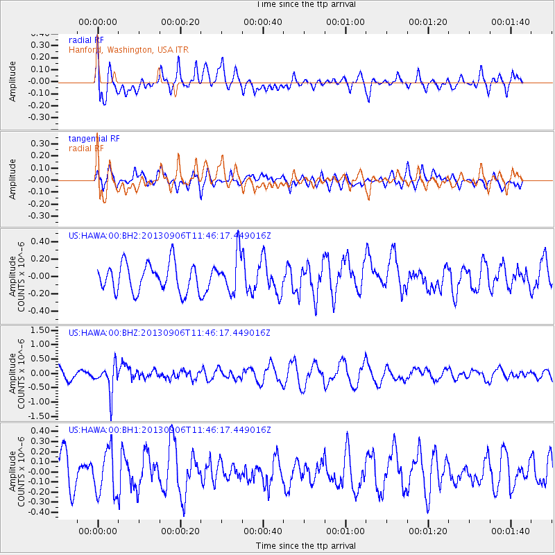
HAWA Hanford, Washington, USA - Earthquake Result Viewer
*The percent match for this event was below the threshold and hence no stack was calculated.
| Earthquake location: |
Philippine Islands Region |
| Earthquake latitude/longitude: |
20.2/122.3 |
| Earthquake time(UTC): |
2013/09/06 (249) 11:33:53 GMT |
| Earthquake Depth: |
175 km |
| Earthquake Magnitude: |
5.9 MWW, 5.9 MWW, 6.0 MWC, 6.0 MWB |
| Earthquake Catalog/Contributor: |
NEIC PDE/NEIC COMCAT |
|
| Network: |
US United States National Seismic Network |
| Station: |
HAWA Hanford, Washington, USA |
| Lat/Lon: |
46.39 N/119.53 W |
| Elevation: |
364 m |
|
| Distance: |
93.4 deg |
| Az: |
37.688 deg |
| Baz: |
303.925 deg |
| Ray Param: |
$rayparam |
*The percent match for this event was below the threshold and hence was not used in the summary stack. |
|
| Radial Match: |
41.994064 % |
| Radial Bump: |
400 |
| Transverse Match: |
63.09331 % |
| Transverse Bump: |
400 |
| SOD ConfigId: |
626651 |
| Insert Time: |
2014-04-18 14:43:30.176 +0000 |
| GWidth: |
2.5 |
| Max Bumps: |
400 |
| Tol: |
0.001 |
|
Signal To Noise
| Channel | StoN | STA | LTA |
| US:HAWA:00:BHZ:20130906T11:46:17.449016Z | 3.5418837 | 4.934065E-7 | 1.3930624E-7 |
| US:HAWA:00:BH1:20130906T11:46:17.449016Z | 1.3652204 | 2.2693351E-7 | 1.6622482E-7 |
| US:HAWA:00:BH2:20130906T11:46:17.449016Z | 1.3893371 | 2.253238E-7 | 1.621808E-7 |
| Arrivals |
| Ps | |
| PpPs | |
| PsPs/PpSs | |


