You are here: Home > Network List > UW - Pacific Northwest Regional Seismic Network Stations List
> Station LEBA Lebam, WA, USA > Earthquake Result Viewer
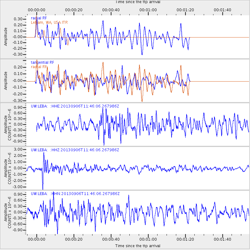
LEBA Lebam, WA, USA - Earthquake Result Viewer
*The percent match for this event was below the threshold and hence no stack was calculated.
| Earthquake location: |
Philippine Islands Region |
| Earthquake latitude/longitude: |
20.2/122.3 |
| Earthquake time(UTC): |
2013/09/06 (249) 11:33:53 GMT |
| Earthquake Depth: |
175 km |
| Earthquake Magnitude: |
5.9 MWW, 5.9 MWW, 6.0 MWC, 6.0 MWB |
| Earthquake Catalog/Contributor: |
NEIC PDE/NEIC COMCAT |
|
| Network: |
UW Pacific Northwest Regional Seismic Network |
| Station: |
LEBA Lebam, WA, USA |
| Lat/Lon: |
46.55 N/123.56 W |
| Elevation: |
73 m |
|
| Distance: |
91.0 deg |
| Az: |
39.053 deg |
| Baz: |
300.96 deg |
| Ray Param: |
$rayparam |
*The percent match for this event was below the threshold and hence was not used in the summary stack. |
|
| Radial Match: |
57.73877 % |
| Radial Bump: |
400 |
| Transverse Match: |
50.81262 % |
| Transverse Bump: |
399 |
| SOD ConfigId: |
626651 |
| Insert Time: |
2014-04-18 14:44:06.059 +0000 |
| GWidth: |
2.5 |
| Max Bumps: |
400 |
| Tol: |
0.001 |
|
Signal To Noise
| Channel | StoN | STA | LTA |
| UW:LEBA: :HHZ:20130906T11:46:06.267986Z | 6.0746098 | 1.0109334E-6 | 1.6641947E-7 |
| UW:LEBA: :HHN:20130906T11:46:06.267986Z | 1.3115104 | 2.8308492E-7 | 2.1584648E-7 |
| UW:LEBA: :HHE:20130906T11:46:06.267986Z | 1.2824444 | 2.7103934E-7 | 2.1134588E-7 |
| Arrivals |
| Ps | |
| PpPs | |
| PsPs/PpSs | |


