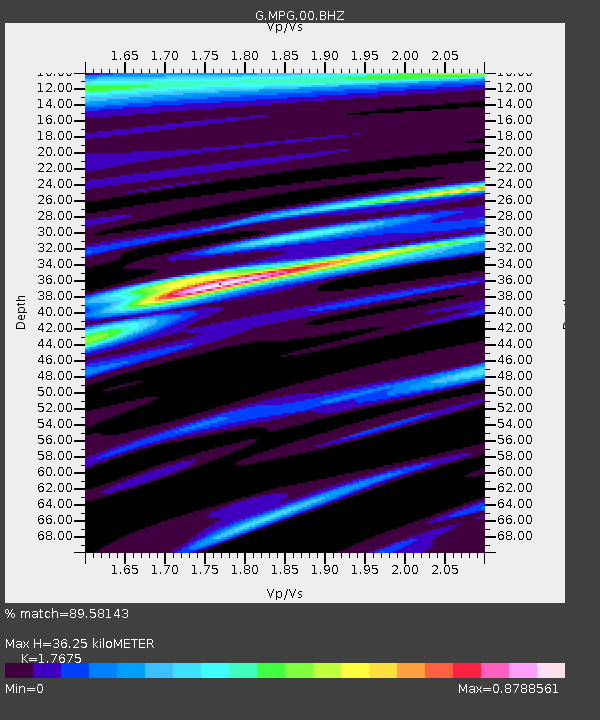
MPG Montagne des Peres, French Guyana - Earthquake Result Viewer
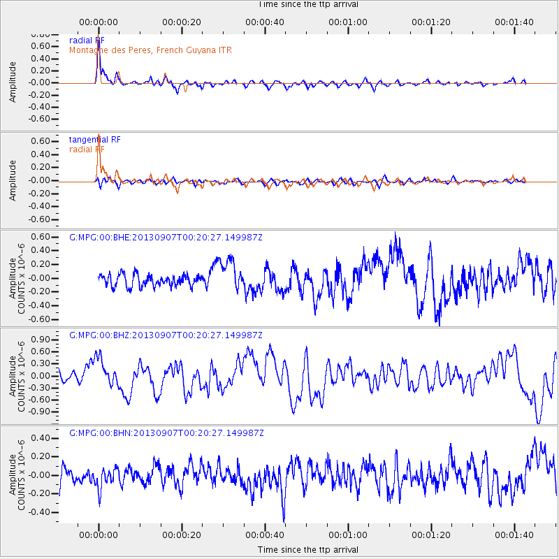
Earthquake location: Near Coast Of Chiapas, Mexico
Earthquake latitude/longitude: 14.6/-92.1
Earthquake time(UTC): 2013/09/07 (250) 00:13:29 GMT
Earthquake Depth: 66 km
Earthquake Magnitude: 6.4 MWW, 6.4 MWB, 6.4 MWC, 6.4 MWW, 6.5 MWC
Earthquake Catalog/Contributor: NEIC PDE/NEIC COMCAT
Network: G GEOSCOPE
Station: MPG Montagne des Peres, French Guyana
Lat/Lon: 5.11 N/52.64 W
Elevation: 147 m
Distance: 40.0 deg
Az: 99.591 deg
Baz: 286.6 deg
Ray Param: 0.07448135
Estimated Moho Depth: 36.25 km
Estimated Crust Vp/Vs: 1.77
Assumed Crust Vp: 6.472 km/s
Estimated Crust Vs: 3.662 km/s
Estimated Crust Poisson's Ratio: 0.26
Radial Match: 89.58143 %
Radial Bump: 383
Transverse Match: 50.571278 %
Transverse Bump: 400
SOD ConfigId: 626651
Insert Time: 2014-04-18 14:52:52.775 +0000
GWidth: 2.5
Max Bumps: 400
Tol: 0.001

Signal To Noise

ChannelStoNSTALTA
G:MPG:00:BHZ:20130907T00:20:27.149987Z2.8721613.5520787E-71.2367269E-7
G:MPG:00:BHN:20130907T00:20:27.149987Z1.31338631.1165336E-78.501181E-8
G:MPG:00:BHE:20130907T00:20:27.149987Z2.76831482.299143E-78.305208E-8
Arrivals
Ps4.6 SECOND
PpPs14 SECOND
PsPs/PpSs19 SECOND