PMSA Palmer Station, Antarctica - Earthquake Result Viewer
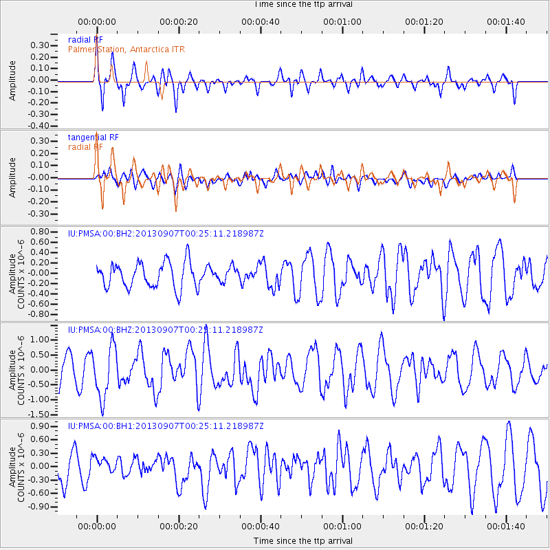
Earthquake location: Near Coast Of Chiapas, Mexico
Earthquake latitude/longitude: 14.6/-92.1
Earthquake time(UTC): 2013/09/07 (250) 00:13:29 GMT
Earthquake Depth: 66 km
Earthquake Magnitude: 6.4 MWW, 6.4 MWB, 6.4 MWC, 6.4 MWW, 6.5 MWC
Earthquake Catalog/Contributor: NEIC PDE/NEIC COMCAT
Network: IU Global Seismograph Network (GSN - IRIS/USGS)
Station: PMSA Palmer Station, Antarctica
Lat/Lon: 64.77 S/64.05 W
Elevation: 40 m
Distance: 82.0 deg
Az: 168.249 deg
Baz: 332.608 deg
Ray Param: 0.04708126
Estimated Moho Depth: 38.25 km
Estimated Crust Vp/Vs: 1.60
Assumed Crust Vp: 6.183 km/s
Estimated Crust Vs: 3.864 km/s
Estimated Crust Poisson's Ratio: 0.18
Radial Match: 81.18969 %
Radial Bump: 357
Transverse Match: 41.331978 %
Transverse Bump: 400
SOD ConfigId: 626651
Insert Time: 2014-04-18 14:55:43.637 +0000
GWidth: 2.5
Max Bumps: 400
Tol: 0.001

Signal To Noise

ChannelStoNSTALTA
IU:PMSA:00:BHZ:20130907T00:25:11.218987Z2.16071138.686643E-74.02027E-7
IU:PMSA:00:BH1:20130907T00:25:11.218987Z0.481925131.7477994E-73.626703E-7
IU:PMSA:00:BH2:20130907T00:25:11.218987Z0.552604141.3865692E-72.5091546E-7
Arrivals
Ps3.8 SECOND
PpPs16 SECOND
PsPs/PpSs19 SECOND