FXWY Fox Creek, Wyoming, USA - Earthquake Result Viewer
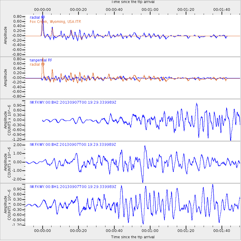
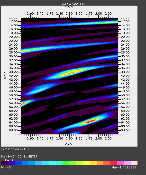
Earthquake location: Near Coast Of Chiapas, Mexico
Earthquake latitude/longitude: 14.6/-92.1
Earthquake time(UTC): 2013/09/07 (250) 00:13:29 GMT
Earthquake Depth: 66 km
Earthquake Magnitude: 6.4 MWW, 6.4 MWB, 6.4 MWC, 6.4 MWW, 6.5 MWC
Earthquake Catalog/Contributor: NEIC PDE/NEIC COMCAT
Network: IW Intermountain West
Station: FXWY Fox Creek, Wyoming, USA
Lat/Lon: 43.64 N/111.03 W
Elevation: 2254 m
Distance: 33.1 deg
Az: 334.519 deg
Baz: 144.994 deg
Ray Param: 0.0781768
Estimated Moho Depth: 54.25 km
Estimated Crust Vp/Vs: 1.60
Assumed Crust Vp: 6.207 km/s
Estimated Crust Vs: 3.879 km/s
Estimated Crust Poisson's Ratio: 0.18
Radial Match: 93.21095 %
Radial Bump: 364
Transverse Match: 83.89952 %
Transverse Bump: 400
SOD ConfigId: 626651
Insert Time: 2014-04-18 14:56:40.863 +0000
GWidth: 2.5
Max Bumps: 400
Tol: 0.001

Signal To Noise

ChannelStoNSTALTA
IW:FXWY:00:BHZ:20130907T00:19:29.339989Z3.35064482.1376563E-76.379836E-8
IW:FXWY:00:BH1:20130907T00:19:29.339989Z3.47281621.7377555E-75.0038793E-8
IW:FXWY:00:BH2:20130907T00:19:29.339989Z1.10900689.292054E-88.378717E-8
Arrivals
Ps5.7 SECOND
PpPs21 SECOND
PsPs/PpSs27 SECOND