MOOW Moose Ponds, Wyoming, USA - Earthquake Result Viewer
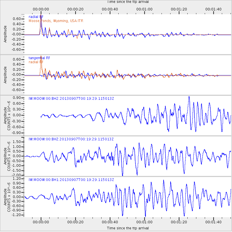
Earthquake location: Near Coast Of Chiapas, Mexico
Earthquake latitude/longitude: 14.6/-92.1
Earthquake time(UTC): 2013/09/07 (250) 00:13:29 GMT
Earthquake Depth: 66 km
Earthquake Magnitude: 6.4 MWW, 6.4 MWB, 6.4 MWC, 6.4 MWW, 6.5 MWC
Earthquake Catalog/Contributor: NEIC PDE/NEIC COMCAT
Network: IW Intermountain West
Station: MOOW Moose Ponds, Wyoming, USA
Lat/Lon: 43.75 N/110.74 W
Elevation: 2128 m
Distance: 33.1 deg
Az: 334.941 deg
Baz: 145.542 deg
Ray Param: 0.07818862
Estimated Moho Depth: 45.0 km
Estimated Crust Vp/Vs: 1.71
Assumed Crust Vp: 6.207 km/s
Estimated Crust Vs: 3.64 km/s
Estimated Crust Poisson's Ratio: 0.24
Radial Match: 91.71871 %
Radial Bump: 328
Transverse Match: 81.07084 %
Transverse Bump: 400
SOD ConfigId: 626651
Insert Time: 2014-04-18 14:56:52.702 +0000
GWidth: 2.5
Max Bumps: 400
Tol: 0.001

Signal To Noise

ChannelStoNSTALTA
IW:MOOW:00:BHZ:20130907T00:19:29.115013Z5.8179473.1802924E-75.466348E-8
IW:MOOW:00:BH1:20130907T00:19:29.115013Z1.53819111.1029438E-77.170395E-8
IW:MOOW:00:BH2:20130907T00:19:29.115013Z3.2372151.5070005E-74.6552373E-8
Arrivals
Ps5.5 SECOND
PpPs18 SECOND
PsPs/PpSs24 SECOND