You are here: Home > Network List > CI - Caltech Regional Seismic Network Stations List
> Station TIN Tinemaha, California, USA > Earthquake Result Viewer
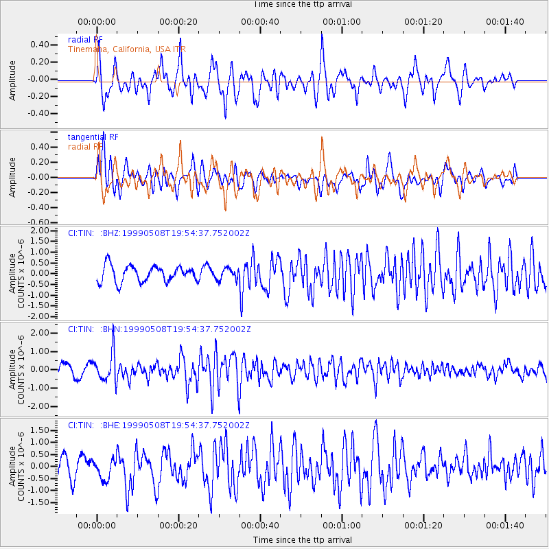
TIN Tinemaha, California, USA - Earthquake Result Viewer
*The percent match for this event was below the threshold and hence no stack was calculated.
| Earthquake location: |
Kuril Islands |
| Earthquake latitude/longitude: |
45.4/151.6 |
| Earthquake time(UTC): |
1999/05/08 (128) 19:44:35 GMT |
| Earthquake Depth: |
63 km |
| Earthquake Magnitude: |
6.2 MB, 5.3 MS, 5.9 MW, 5.9 MW |
| Earthquake Catalog/Contributor: |
WHDF/NEIC |
|
| Network: |
CI Caltech Regional Seismic Network |
| Station: |
TIN Tinemaha, California, USA |
| Lat/Lon: |
37.05 N/118.23 W |
| Elevation: |
1164 m |
|
| Distance: |
64.9 deg |
| Az: |
62.091 deg |
| Baz: |
308.961 deg |
| Ray Param: |
$rayparam |
*The percent match for this event was below the threshold and hence was not used in the summary stack. |
|
| Radial Match: |
76.03091 % |
| Radial Bump: |
400 |
| Transverse Match: |
75.04468 % |
| Transverse Bump: |
400 |
| SOD ConfigId: |
4480 |
| Insert Time: |
2010-02-25 20:52:07.806 +0000 |
| GWidth: |
2.5 |
| Max Bumps: |
400 |
| Tol: |
0.001 |
|
Signal To Noise
| Channel | StoN | STA | LTA |
| CI:TIN: :BHN:19990508T19:54:37.752002Z | 2.7412941 | 8.1957944E-7 | 2.9897538E-7 |
| CI:TIN: :BHE:19990508T19:54:37.752002Z | 0.9405617 | 4.4596166E-7 | 4.7414397E-7 |
| CI:TIN: :BHZ:19990508T19:54:37.752002Z | 0.70235187 | 2.6364782E-7 | 3.7537856E-7 |
| Arrivals |
| Ps | |
| PpPs | |
| PsPs/PpSs | |


