A04D Lummi Island, WA, USA - Earthquake Result Viewer
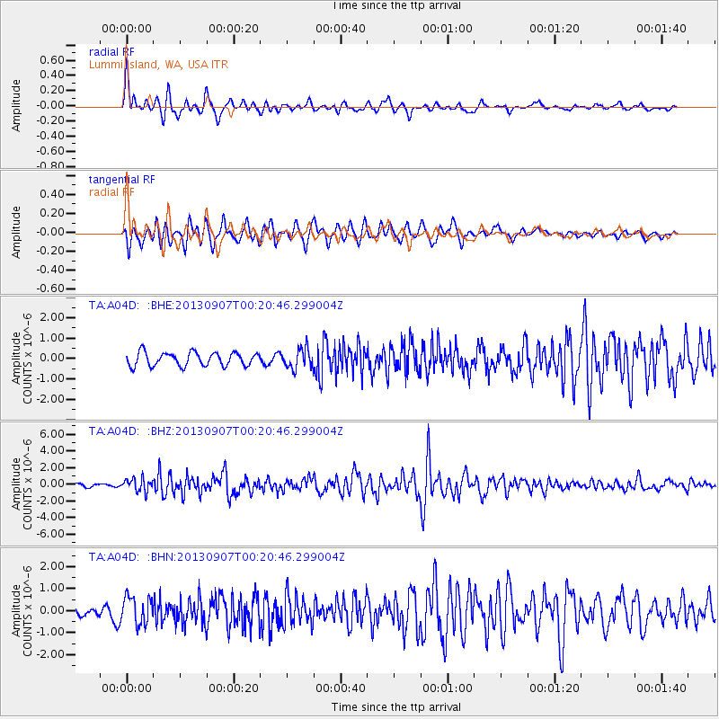
Earthquake location: Near Coast Of Chiapas, Mexico
Earthquake latitude/longitude: 14.6/-92.1
Earthquake time(UTC): 2013/09/07 (250) 00:13:29 GMT
Earthquake Depth: 66 km
Earthquake Magnitude: 6.4 MWW, 6.4 MWB, 6.4 MWC, 6.4 MWW, 6.5 MWC
Earthquake Catalog/Contributor: NEIC PDE/NEIC COMCAT
Network: TA USArray Transportable Network (new EarthScope stations)
Station: A04D Lummi Island, WA, USA
Lat/Lon: 48.72 N/122.71 W
Elevation: 13 m
Distance: 42.3 deg
Az: 329.953 deg
Baz: 132.948 deg
Ray Param: 0.07307068
Estimated Moho Depth: 43.5 km
Estimated Crust Vp/Vs: 2.10
Assumed Crust Vp: 6.566 km/s
Estimated Crust Vs: 3.13 km/s
Estimated Crust Poisson's Ratio: 0.35
Radial Match: 81.2467 %
Radial Bump: 400
Transverse Match: 85.93474 %
Transverse Bump: 400
SOD ConfigId: 626651
Insert Time: 2014-04-18 15:03:01.846 +0000
GWidth: 2.5
Max Bumps: 400
Tol: 0.001

Signal To Noise

ChannelStoNSTALTA
TA:A04D: :BHZ:20130907T00:20:46.299004Z4.8622977.749618E-71.5938183E-7
TA:A04D: :BHN:20130907T00:20:46.299004Z2.58572346.302759E-72.4375225E-7
TA:A04D: :BHE:20130907T00:20:46.299004Z1.46231934.797141E-73.280502E-7
Arrivals
Ps7.7 SECOND
PpPs19 SECOND
PsPs/PpSs27 SECOND