C06D Leavenworth, WQ, USA - Earthquake Result Viewer
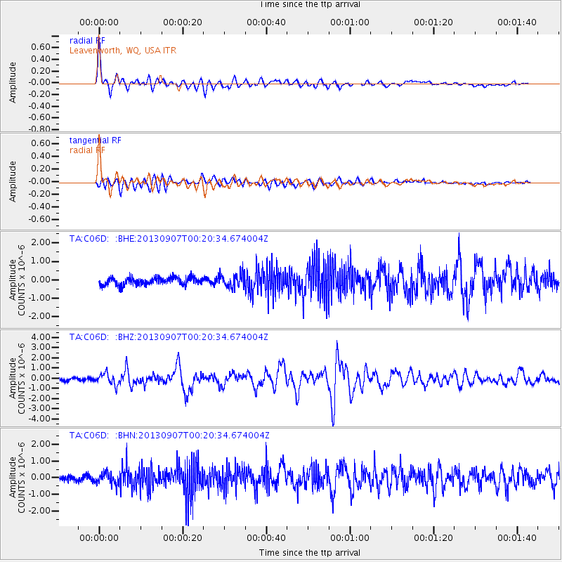
Earthquake location: Near Coast Of Chiapas, Mexico
Earthquake latitude/longitude: 14.6/-92.1
Earthquake time(UTC): 2013/09/07 (250) 00:13:29 GMT
Earthquake Depth: 66 km
Earthquake Magnitude: 6.4 MWW, 6.4 MWB, 6.4 MWC, 6.4 MWW, 6.5 MWC
Earthquake Catalog/Contributor: NEIC PDE/NEIC COMCAT
Network: TA USArray Transportable Network (new EarthScope stations)
Station: C06D Leavenworth, WQ, USA
Lat/Lon: 47.92 N/120.89 W
Elevation: 544 m
Distance: 40.9 deg
Az: 330.345 deg
Baz: 134.591 deg
Ray Param: 0.07394213
Estimated Moho Depth: 55.0 km
Estimated Crust Vp/Vs: 1.60
Assumed Crust Vp: 6.597 km/s
Estimated Crust Vs: 4.117 km/s
Estimated Crust Poisson's Ratio: 0.18
Radial Match: 89.99541 %
Radial Bump: 400
Transverse Match: 85.96949 %
Transverse Bump: 400
SOD ConfigId: 626651
Insert Time: 2014-04-18 15:03:09.881 +0000
GWidth: 2.5
Max Bumps: 400
Tol: 0.001

Signal To Noise

ChannelStoNSTALTA
TA:C06D: :BHZ:20130907T00:20:34.674004Z4.09683045.668238E-71.3835667E-7
TA:C06D: :BHN:20130907T00:20:34.674004Z2.47305183.424801E-71.384848E-7
TA:C06D: :BHE:20130907T00:20:34.674004Z1.81935353.715687E-72.0423117E-7
Arrivals
Ps5.4 SECOND
PpPs20 SECOND
PsPs/PpSs25 SECOND