D41A Chassel, MI, USA - Earthquake Result Viewer
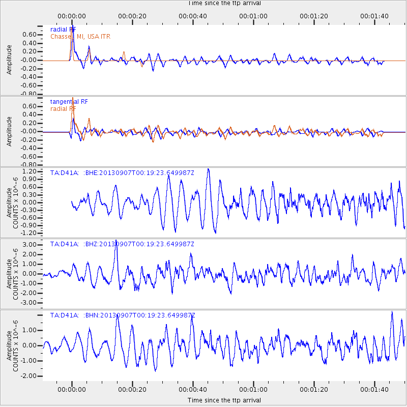
Earthquake location: Near Coast Of Chiapas, Mexico
Earthquake latitude/longitude: 14.6/-92.1
Earthquake time(UTC): 2013/09/07 (250) 00:13:29 GMT
Earthquake Depth: 66 km
Earthquake Magnitude: 6.4 MWW, 6.4 MWB, 6.4 MWC, 6.4 MWW, 6.5 MWC
Earthquake Catalog/Contributor: NEIC PDE/NEIC COMCAT
Network: TA USArray Transportable Network (new EarthScope stations)
Station: D41A Chassel, MI, USA
Lat/Lon: 47.06 N/88.57 W
Elevation: 271 m
Distance: 32.5 deg
Az: 4.526 deg
Baz: 186.416 deg
Ray Param: 0.07847594
Estimated Moho Depth: 57.0 km
Estimated Crust Vp/Vs: 1.62
Assumed Crust Vp: 6.467 km/s
Estimated Crust Vs: 4.004 km/s
Estimated Crust Poisson's Ratio: 0.19
Radial Match: 80.736626 %
Radial Bump: 343
Transverse Match: 67.636314 %
Transverse Bump: 400
SOD ConfigId: 626651
Insert Time: 2014-04-18 15:03:22.218 +0000
GWidth: 2.5
Max Bumps: 400
Tol: 0.001

Signal To Noise

ChannelStoNSTALTA
TA:D41A: :BHZ:20130907T00:19:23.649987Z2.02068925.341416E-72.6433634E-7
TA:D41A: :BHN:20130907T00:19:23.649987Z2.01429135.679297E-72.8195015E-7
TA:D41A: :BHE:20130907T00:19:23.649987Z2.69850667.1503376E-72.649739E-7
Arrivals
Ps5.9 SECOND
PpPs21 SECOND
PsPs/PpSs27 SECOND