D51A Lot 18 Range III Mazenod Township, QC, CAN - Earthquake Result Viewer
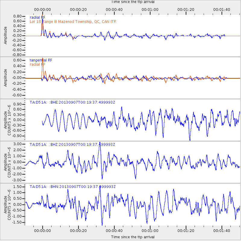
Earthquake location: Near Coast Of Chiapas, Mexico
Earthquake latitude/longitude: 14.6/-92.1
Earthquake time(UTC): 2013/09/07 (250) 00:13:29 GMT
Earthquake Depth: 66 km
Earthquake Magnitude: 6.4 MWW, 6.4 MWB, 6.4 MWC, 6.4 MWW, 6.5 MWC
Earthquake Catalog/Contributor: NEIC PDE/NEIC COMCAT
Network: TA USArray Transportable Network (new EarthScope stations)
Station: D51A Lot 18 Range III Mazenod Township, QC, CAN
Lat/Lon: 47.09 N/79.37 W
Elevation: 282 m
Distance: 34.1 deg
Az: 15.604 deg
Baz: 202.402 deg
Ray Param: 0.0777384
Estimated Moho Depth: 16.75 km
Estimated Crust Vp/Vs: 1.60
Assumed Crust Vp: 6.622 km/s
Estimated Crust Vs: 4.139 km/s
Estimated Crust Poisson's Ratio: 0.18
Radial Match: 80.47485 %
Radial Bump: 358
Transverse Match: 58.060112 %
Transverse Bump: 400
SOD ConfigId: 626651
Insert Time: 2014-04-18 15:03:37.584 +0000
GWidth: 2.5
Max Bumps: 400
Tol: 0.001

Signal To Noise

ChannelStoNSTALTA
TA:D51A: :BHZ:20130907T00:19:37.499993Z3.071667.370542E-72.3995307E-7
TA:D51A: :BHN:20130907T00:19:37.499993Z3.1085593.8496015E-71.2383877E-7
TA:D51A: :BHE:20130907T00:19:37.499993Z0.62981152.090977E-73.3200047E-7
Arrivals
Ps1.7 SECOND
PpPs6.0 SECOND
PsPs/PpSs7.7 SECOND