D56A ZEC Mazanza, Mont-Saint-Michel, QC, CAN - Earthquake Result Viewer
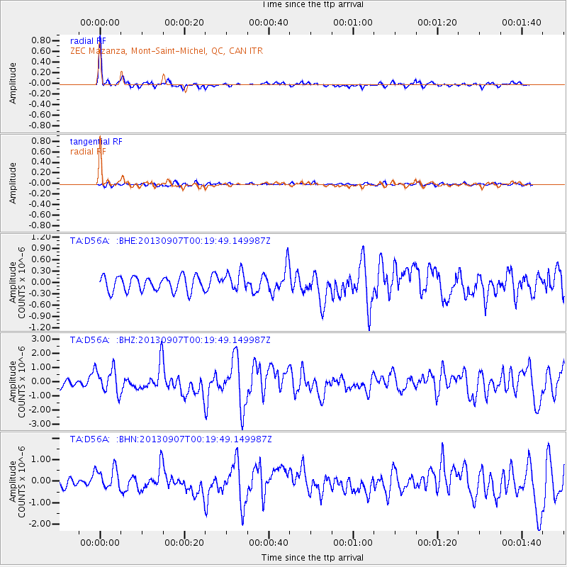
Earthquake location: Near Coast Of Chiapas, Mexico
Earthquake latitude/longitude: 14.6/-92.1
Earthquake time(UTC): 2013/09/07 (250) 00:13:29 GMT
Earthquake Depth: 66 km
Earthquake Magnitude: 6.4 MWW, 6.4 MWB, 6.4 MWC, 6.4 MWW, 6.5 MWC
Earthquake Catalog/Contributor: NEIC PDE/NEIC COMCAT
Network: TA USArray Transportable Network (new EarthScope stations)
Station: D56A ZEC Mazanza, Mont-Saint-Michel, QC, CAN
Lat/Lon: 47.05 N/74.76 W
Elevation: 421 m
Distance: 35.4 deg
Az: 20.605 deg
Baz: 209.881 deg
Ray Param: 0.0770319
Estimated Moho Depth: 41.25 km
Estimated Crust Vp/Vs: 1.81
Assumed Crust Vp: 6.61 km/s
Estimated Crust Vs: 3.657 km/s
Estimated Crust Poisson's Ratio: 0.28
Radial Match: 91.52856 %
Radial Bump: 362
Transverse Match: 52.67561 %
Transverse Bump: 400
SOD ConfigId: 626651
Insert Time: 2014-04-18 15:03:53.920 +0000
GWidth: 2.5
Max Bumps: 400
Tol: 0.001

Signal To Noise

ChannelStoNSTALTA
TA:D56A: :BHZ:20130907T00:19:49.149987Z2.78734548.546599E-73.0662144E-7
TA:D56A: :BHN:20130907T00:19:49.149987Z2.32649664.973079E-72.1375826E-7
TA:D56A: :BHE:20130907T00:19:49.149987Z1.24090222.4384042E-71.9650255E-7
Arrivals
Ps5.5 SECOND
PpPs16 SECOND
PsPs/PpSs22 SECOND