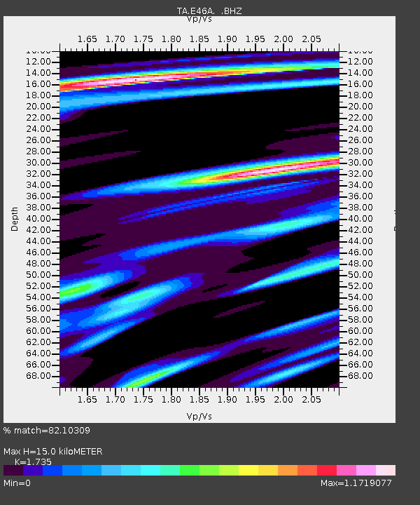
E46A Sault Ste Marie, MI, USA - Earthquake Result Viewer
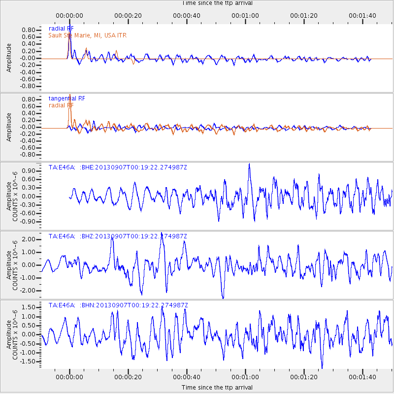
Earthquake location: Near Coast Of Chiapas, Mexico
Earthquake latitude/longitude: 14.6/-92.1
Earthquake time(UTC): 2013/09/07 (250) 00:13:29 GMT
Earthquake Depth: 66 km
Earthquake Magnitude: 6.4 MWW, 6.4 MWB, 6.4 MWC, 6.4 MWW, 6.5 MWC
Earthquake Catalog/Contributor: NEIC PDE/NEIC COMCAT
Network: TA USArray Transportable Network (new EarthScope stations)
Station: E46A Sault Ste Marie, MI, USA
Lat/Lon: 46.37 N/84.31 W
Elevation: 269 m
Distance: 32.3 deg
Az: 10.138 deg
Baz: 194.246 deg
Ray Param: 0.0785426
Estimated Moho Depth: 15.0 km
Estimated Crust Vp/Vs: 1.74
Assumed Crust Vp: 6.467 km/s
Estimated Crust Vs: 3.727 km/s
Estimated Crust Poisson's Ratio: 0.25
Radial Match: 82.10309 %
Radial Bump: 400
Transverse Match: 68.2993 %
Transverse Bump: 400
SOD ConfigId: 626651
Insert Time: 2014-04-18 15:04:25.848 +0000
GWidth: 2.5
Max Bumps: 400
Tol: 0.001

Signal To Noise

ChannelStoNSTALTA
TA:E46A: :BHZ:20130907T00:19:22.274987Z1.54726924.337152E-72.803101E-7
TA:E46A: :BHN:20130907T00:19:22.274987Z2.04405364.976339E-72.4345442E-7
TA:E46A: :BHE:20130907T00:19:22.274987Z0.828782441.7925659E-72.1628908E-7
Arrivals
Ps1.9 SECOND
PpPs5.8 SECOND
PsPs/PpSs7.7 SECOND