
E51A G1948 Merrick Township, ON, CAN - Earthquake Result Viewer
| ||||||||||||||||||
| ||||||||||||||||||
| ||||||||||||||||||
|
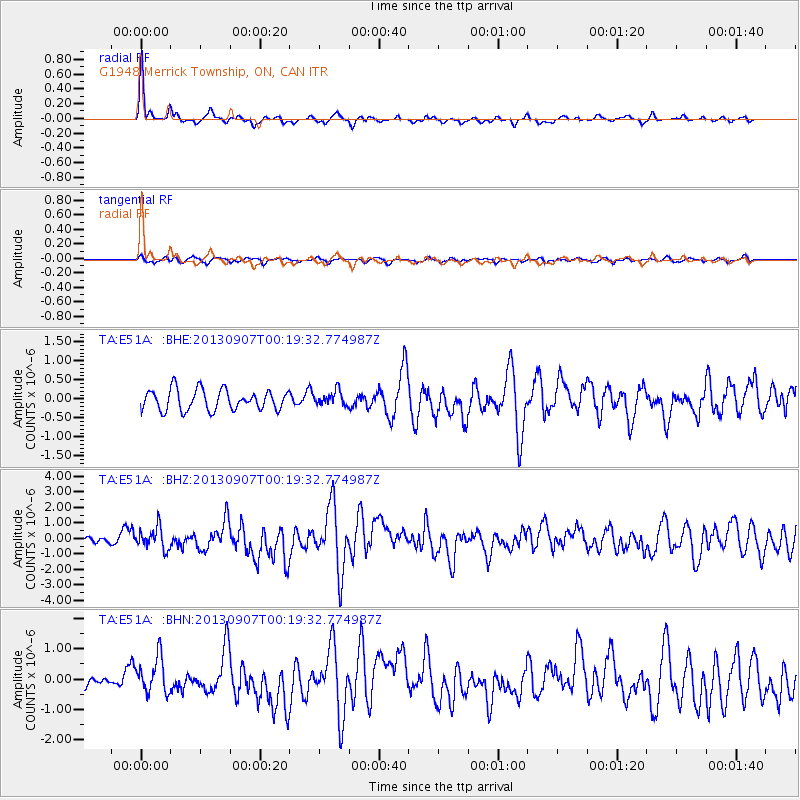
Signal To Noise
| Channel | StoN | STA | LTA |
| TA:E51A: :BHZ:20130907T00:19:32.774987Z | 2.3663833 | 6.931304E-7 | 2.9290706E-7 |
| TA:E51A: :BHN:20130907T00:19:32.774987Z | 2.8810716 | 5.901205E-7 | 2.0482676E-7 |
| TA:E51A: :BHE:20130907T00:19:32.774987Z | 0.7069971 | 1.898924E-7 | 2.6859007E-7 |
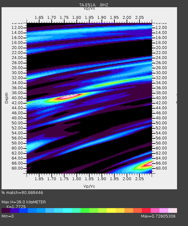
| Arrivals | |
| Ps | 4.9 SECOND |
| PpPs | 15 SECOND |
| PsPs/PpSs | 20 SECOND |

