
E58A La Victoria, QC, CAN - Earthquake Result Viewer
| ||||||||||||||||||
| ||||||||||||||||||
| ||||||||||||||||||
|
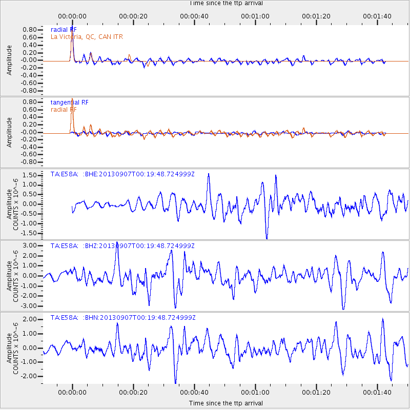
Signal To Noise
| Channel | StoN | STA | LTA |
| TA:E58A: :BHZ:20130907T00:19:48.724999Z | 2.6384525 | 5.531608E-7 | 2.0965352E-7 |
| TA:E58A: :BHN:20130907T00:19:48.724999Z | 1.9317788 | 3.1930318E-7 | 1.6528972E-7 |
| TA:E58A: :BHE:20130907T00:19:48.724999Z | 2.7321253 | 4.491364E-7 | 1.6439085E-7 |
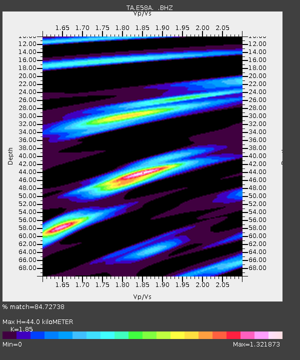
| Arrivals | |
| Ps | 6.1 SECOND |
| PpPs | 18 SECOND |
| PsPs/PpSs | 24 SECOND |

