
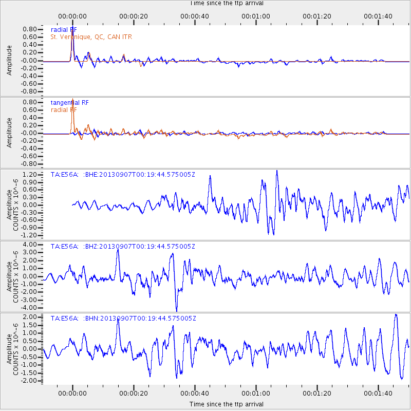
E56A St. Veronique, QC, CAN - Earthquake Result Viewer
| ||||||||||||||||||
| ||||||||||||||||||
| ||||||||||||||||||
|
Signal To Noise
| Channel | StoN | STA | LTA |
| TA:E56A: :BHZ:20130907T00:19:44.575005Z | 3.4219956 | 7.8162236E-7 | 2.2841128E-7 |
| TA:E56A: :BHN:20130907T00:19:44.575005Z | 3.3036516 | 5.3072404E-7 | 1.606477E-7 |
| TA:E56A: :BHE:20130907T00:19:44.575005Z | 2.6208272 | 2.8080208E-7 | 1.0714254E-7 |
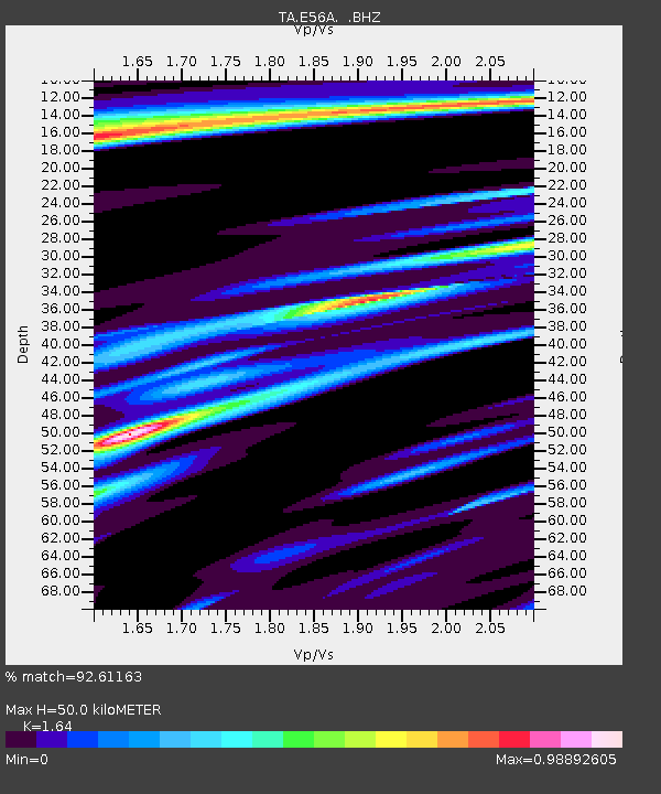
| Arrivals | |
| Ps | 5.3 SECOND |
| PpPs | 18 SECOND |
| PsPs/PpSs | 24 SECOND |

