F61A St Evariste, QC, CAN - Earthquake Result Viewer
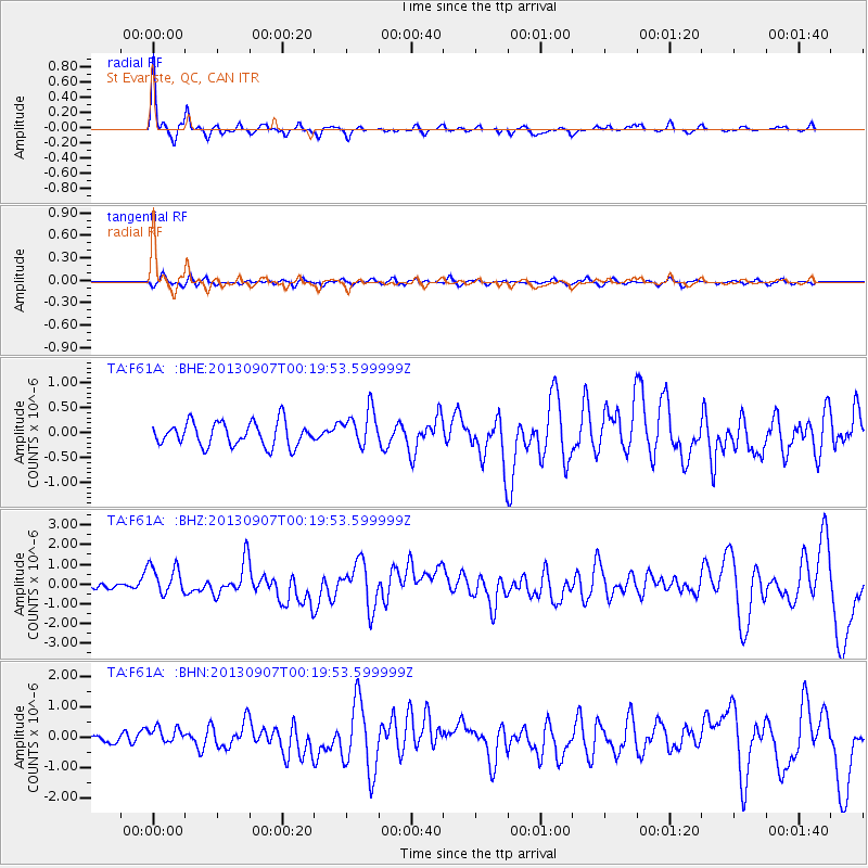
Earthquake location: Near Coast Of Chiapas, Mexico
Earthquake latitude/longitude: 14.6/-92.1
Earthquake time(UTC): 2013/09/07 (250) 00:13:29 GMT
Earthquake Depth: 66 km
Earthquake Magnitude: 6.4 MWW, 6.4 MWB, 6.4 MWC, 6.4 MWW, 6.5 MWC
Earthquake Catalog/Contributor: NEIC PDE/NEIC COMCAT
Network: TA USArray Transportable Network (new EarthScope stations)
Station: F61A St Evariste, QC, CAN
Lat/Lon: 45.97 N/70.99 W
Elevation: 350 m
Distance: 36.0 deg
Az: 25.341 deg
Baz: 216.452 deg
Ray Param: 0.076747715
Estimated Moho Depth: 29.0 km
Estimated Crust Vp/Vs: 2.08
Assumed Crust Vp: 6.419 km/s
Estimated Crust Vs: 3.086 km/s
Estimated Crust Poisson's Ratio: 0.35
Radial Match: 87.474335 %
Radial Bump: 238
Transverse Match: 44.292812 %
Transverse Bump: 400
SOD ConfigId: 626651
Insert Time: 2014-04-18 15:05:40.868 +0000
GWidth: 2.5
Max Bumps: 400
Tol: 0.001

Signal To Noise

ChannelStoNSTALTA
TA:F61A: :BHZ:20130907T00:19:53.599999Z3.22945267.645087E-72.3673012E-7
TA:F61A: :BHN:20130907T00:19:53.599999Z1.675212.878001E-71.7179941E-7
TA:F61A: :BHE:20130907T00:19:53.599999Z1.56853953.726872E-72.3760143E-7
Arrivals
Ps5.2 SECOND
PpPs13 SECOND
PsPs/PpSs18 SECOND