
G40A Rib Lake, WI, USA - Earthquake Result Viewer
| ||||||||||||||||||
| ||||||||||||||||||
| ||||||||||||||||||
|
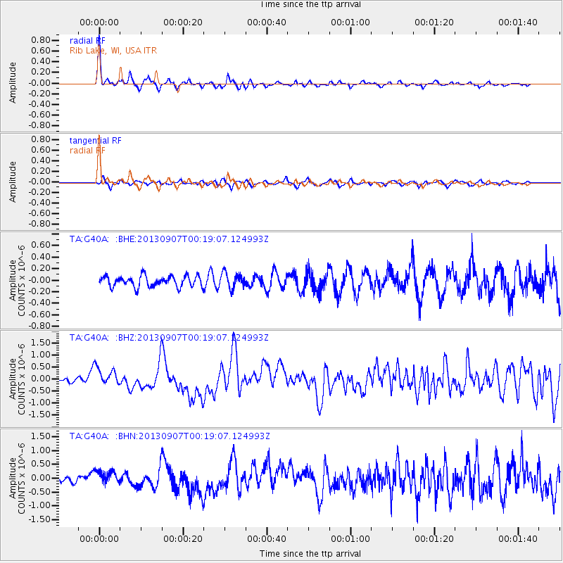
Signal To Noise
| Channel | StoN | STA | LTA |
| TA:G40A: :BHZ:20130907T00:19:07.124993Z | 2.5133612 | 3.608722E-7 | 1.4358152E-7 |
| TA:G40A: :BHN:20130907T00:19:07.124993Z | 2.517183 | 2.5012437E-7 | 9.936678E-8 |
| TA:G40A: :BHE:20130907T00:19:07.124993Z | 1.4577535 | 1.3544583E-7 | 9.2914085E-8 |
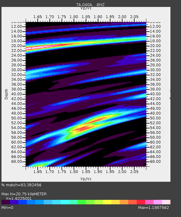
| Arrivals | |
| Ps | 2.2 SECOND |
| PpPs | 7.5 SECOND |
| PsPs/PpSs | 9.7 SECOND |

