H17A Grant Village (NPS), Yellowstone Nt. Park, WY, USA - Earthquake Result Viewer
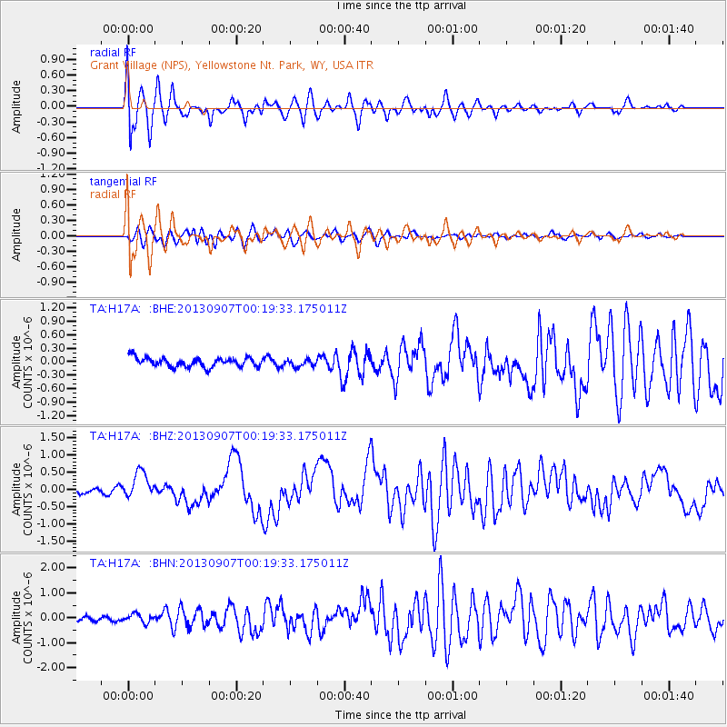
Earthquake location: Near Coast Of Chiapas, Mexico
Earthquake latitude/longitude: 14.6/-92.1
Earthquake time(UTC): 2013/09/07 (250) 00:13:29 GMT
Earthquake Depth: 66 km
Earthquake Magnitude: 6.4 MWW, 6.4 MWB, 6.4 MWC, 6.4 MWW, 6.5 MWC
Earthquake Catalog/Contributor: NEIC PDE/NEIC COMCAT
Network: TA USArray Transportable Network (new EarthScope stations)
Station: H17A Grant Village (NPS), Yellowstone Nt. Park, WY, USA
Lat/Lon: 44.40 N/110.58 W
Elevation: 2400 m
Distance: 33.6 deg
Az: 335.783 deg
Baz: 146.362 deg
Ray Param: 0.077974044
Estimated Moho Depth: 20.75 km
Estimated Crust Vp/Vs: 1.73
Assumed Crust Vp: 6.35 km/s
Estimated Crust Vs: 3.671 km/s
Estimated Crust Poisson's Ratio: 0.25
Radial Match: 80.13983 %
Radial Bump: 400
Transverse Match: 87.73898 %
Transverse Bump: 400
SOD ConfigId: 626651
Insert Time: 2014-04-18 15:06:39.143 +0000
GWidth: 2.5
Max Bumps: 400
Tol: 0.001

Signal To Noise

ChannelStoNSTALTA
TA:H17A: :BHZ:20130907T00:19:33.175011Z5.4768653.7860283E-76.912766E-8
TA:H17A: :BHN:20130907T00:19:33.175011Z1.68288311.7070658E-71.0143698E-7
TA:H17A: :BHE:20130907T00:19:33.175011Z0.75061437.80096E-81.03927675E-7
Arrivals
Ps2.6 SECOND
PpPs8.3 SECOND
PsPs/PpSs11 SECOND